SAILING
AT BRIBIE ISLAND
Bribie Island is 71ilometres from Brisbane on the
Queensland Coast at the northern end of Morton Bay. The waterway between Queensland and Bribie
Island is called Pumisestone passage and is 31 kilometres long.
The passage is a protected marine environment and
is home for a plethora of marine life that includes Dugongs, Dolphins and Sea
Turtles. The passage also is more sheltered than the open waters of Morton Bay
and in all but a strong southerly (except for the southern entrance of the
passage that can get very choppy when there is a strong southerly wind and wind
against tide) does it get too choppy.
Roughly two thirds of Bribie are national Park and
State forest. only the southern end of the island is inhabited with about 15
thousand lucky people. A single bridge gives access to the Island. Unfortunately the bridge is only 5m high
which limits access to these waters
When travelling by car to the island there is a
marina that is a few kilometres before the bridge (within the passage).
Adjacent to the marina is a very good boat ramp there are however also two boat
ramps on the island at both sides of the bridge (see map).
Before venturing out into the bay you should log
on to the Bribie Volunteer Marine Rescue station They can be contacted on
channel 70 (VHF) or on channel 90 27 meghz or by phone on 3408 7596 (Note that
mobile phones don't work in some areas of the passage and Morton bay).
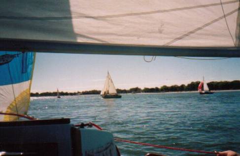
Cruising Grounds
Caloundra
 I
have sailed Cygnet to the northern tip of Bribie Island near the Caloundra
40kms away from home.
I
have sailed Cygnet to the northern tip of Bribie Island near the Caloundra
40kms away from home.
On the way you pass the sleepy villages of Toorbul
& Donnybrook and a great camping site at Mission Point that is run by the
parks and Wildlife.
At about half way one passes through an area aptly
named the skids which is only 0.4m deep at high tide. For obvious reasons you
need to arrive there ideally just before high tide. It is here it feels as
though you are in a jungle or the everglades as mangroves line the channel but
every once in a while you will see a break in the mangroves to the more open
waters of Tripicony Bight.
The passage eventually widens as you approach
Caloundra. Generally it is possible to sail from the boat-ramp at Sylvan beach
(Or from Spinnaker Sound Marina) all the way to Mission Point from Mission
Point to Roy's landing you may have to motor due to the narrow channel. From
Roy's landing all the way to Caloundra if the wind permits you can sail all the
way to Blue Pool.
Blue Pool is a lovely anchorage at the northern
tip of Bribie Island where one can anchor stern to the beach and pretend to be
on your own tropical island. At the
other side of the passage is Caloundra where if you need you can buy food go
out to a restaurant. A short work across the island will bring you to the ocean
side of Bribie Island and if you follow the beach you can see the Caloundra
Bar. It is possible for a trailer sailer to motor out of the bar (I however
wouldn't recommend it). If you must do it when there is not much swell and
after logging on with Caloundra Volunteer Marine Rescue.
Beachmere
To leave from the Island the only boat ramp that
you can use unless you want to go through the drama of raising and lowering
your mast to go under the bridge) is off the esplanade. If your boat has a stub
keel you may have to avoid using the ramp at low tide, as the water is shallow
surrounding the ramp
This is a good day sail and allows you to stop at
the entrance to the Caboolture River for lunch. The current can be strong at
the southern tip of Bribie so if you don't want to use the motor aim to arrive
at the boat ramp on a flood tide.
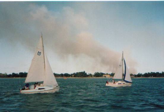
The southern tip of Bribie when there is wind
against tide can get very choppy. One day with about a 20-knot wind and the
tide screaming out the passage and into the bay I actually managed to make
Cygnet surf down a wave near the jetty at Bongaree (Which was exciting!) before
broaching (A bit too exciting!).
![]()