
Another sunny morning prompted my second foray to the Coventry canal at Red Lane. The time 10:30am. The changeable weather over the past week again made necessary the carrying of an umbrella, but the sky indicated I might actually get away with not using it this time. The canal map at the bridge indicated 2 miles to the Coventry Canal Basin. Looking forward to a pleasant morning enjoying the peacefulness of the canal, I clutched my jacket, notepad, pen and Fujica camera and descended the steps at the Red Lane Bridge.
My first photograph was the steps leading to the canal.
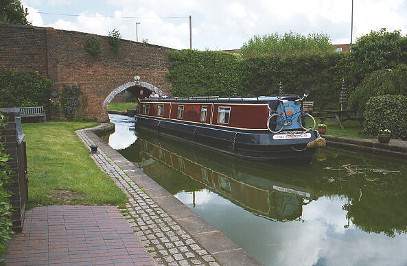
I turned left passing under the Red Lane Bridge; some Long Boats appeared on the right, so I took a photograph of them from under the bridge.
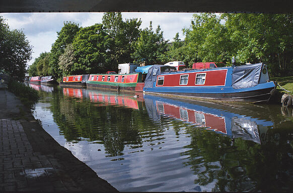
Slightly further along, I came to the canalside footbridge spanning the entrance to the Red Lane boat
basin. Here a few long boats rested and I took their photograph.
The 35mm wide-angle lens on my camera was already proving better suited to capturing the canal than the 50mm lens on my other camera.
Occasionally looking behind me (to look for approaching boats or joggers), I made my way over the footbridge and down the other side along the canal's footpath.
Next, on the right, came into view the former Ordnance Factory. A plaque notes its interesting history.
The factory had a huge lathe which made 15 inch naval guns. Deliveries were also made by a railway spur which formerly crossed the canal on the other side of Red Lane. All traces of the railway and the former railway bridge were obliterated when the nearby railway line became Phoenix Way, a short cut for motorists in a hurry.
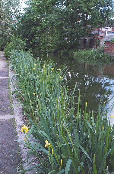
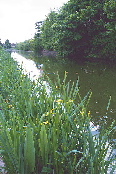
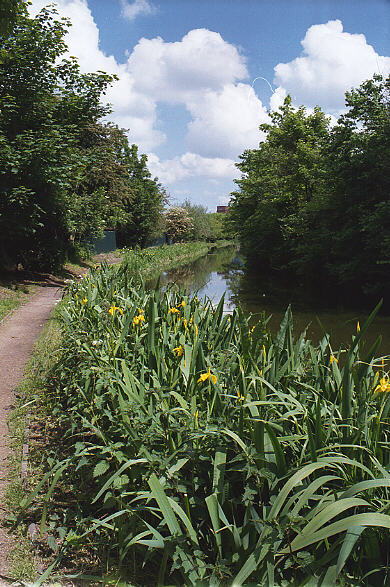
Some moorhens swimming on the canal became evident as the canal curved to the right toward Stoney
Stanton Road. Here I saw a nice canalside growth of yellow irises (planted I suspect) which I photographed
with some mallard ducks. Unfortunately, the ducks are difficult to spot.
 and, a different view,
Next, came some mallards resting along the canal's edge which I duly captured for posterity.
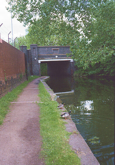
Going under Priestley's bridge at Stoney Stanton Road, the din from a scrap recycling works to the right
assailed my ears. Then I came to the 'fish chairs', on the left.
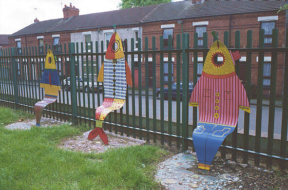
I did not try them out, since they seemed eminently unsuited for their intended purpose. About here, I also saw a few coconuts floating in the canal, which seemed odd to me until I saw a notice indicating that this is an Indian tradition whose purpose now escapes me.
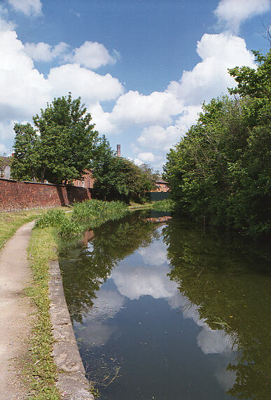
The canal again curved to the right. Here I took a photo of the canal's curve and a chimney in the
distance.
Plus another shot of some yellow irises.
Further along, I approached the Prince William Henry bridge and shot it together with a factory in the
distance.
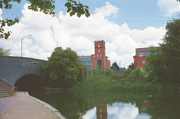
A plaque informed me that the factory was the former Courtaulds works, which made the first man-made fibres, and which closed in 1991.
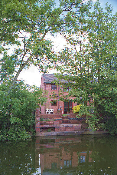
Opening my notebook to make the next entry, I found a squashed green fly from my last entry. Cleaning
this detritus from the page, I noted my next photo, a canalside home with a nicely situated bench.
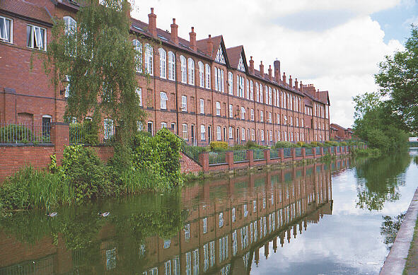
I continued on as the canal curved to the left. Next, on my right, I encountered the impressive canalside
'Cash's Hundred Houses' (built in 1857, 100 were planned but only 48 were built and just 37 remain). These
were the homes and workplaces of the employees of weavers J&J Cash. The living quarters were below and the workshops at the top. The houses were occupied by J&J Cash until 1995. A plaque gives more detail than I can remember here.
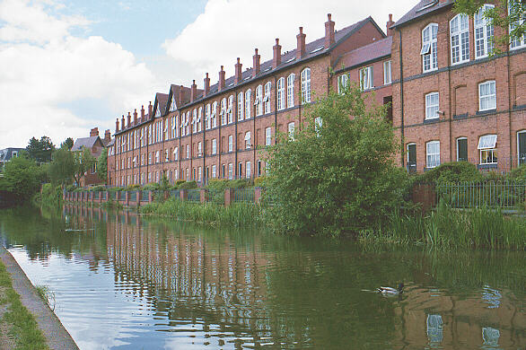 and, looking back the other way,
Here I encountered a woman walking her dog and a jogger coming my way.
A glance at my watch indicated the time to be 11:20am. Just past the houses, I proceeded under an unmarked bridge.
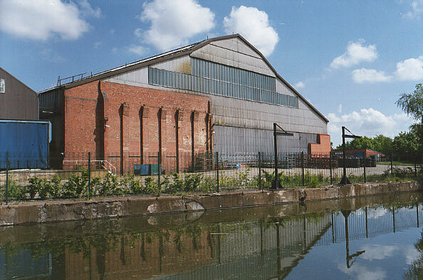
Past the bridge on the right was the uninteresting East Midlands Electricity Building (judging by the signs on the sides of the many vans parked there). Once again the canal curved to the left.
Here came into view the old Daimler factory (built in 1897), whose only evidence was the plaque informing me, and the old Power House which supplied the factory with power. This was a relic I was surprised had survived since it looked in a very dilapidated state. Some people looked at me from a distance with expressions that betrayed 'Why is he photographing THAT?'.
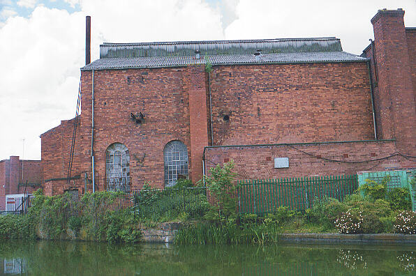
The coal came to this factory by boat. However, a sign indicated the canal spur and wharf has disappeared to become a new housing development.
The canal now curved back to the right and at this point, I first glanced one of Coventry's three church spires through a gap in several gigantic billboards. The back of these billboards obscured a nice view of the city, however, the motorists on the ring road gain the benefit of learning of the latest commercial products.
More delightful yellow irises were passed, followed by the relentless hum of traffic from the ring road on the left. Civilisation was nearby.
Here I spied the 'Wave Seat', unfortunately which for some reason I failed to photograph. Perhaps it was unworthy of my efforts.
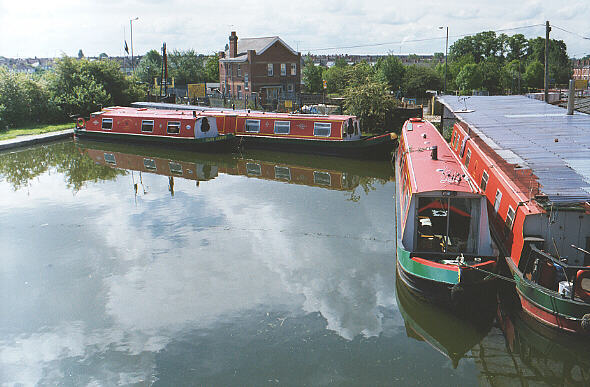
The Drapers Field bridge came into view directly ahead, together with an absolutely outlandish piece or artwork, which some misguided artist is no doubt proud of. Here was the end of the canalside footpath since this bridge has no path (an ancient security measure against 18th century mischief). Exiting the canal, I walked around and over the bridge and followed the signs to the Coventry Canal Basin. The time 11:45am. (photos)
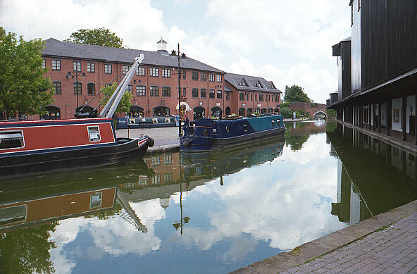
Here, I was lucky enough to be able to photograph a boat entering the canal basin from under the Draper's Field bridge.
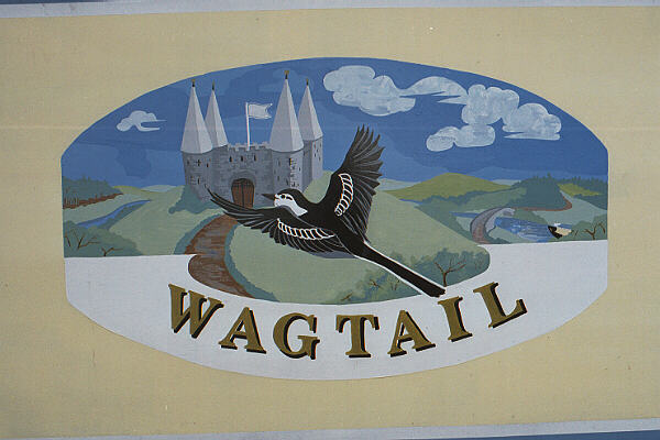
And a painted sign on the side of a docked boat.
The Canal Basin is well worth a visit even by those who are not hikers. It is accesible via a footbridge at
the top of Bishop Street, which is a continuation of the Burges in the city centre.
 and another view,
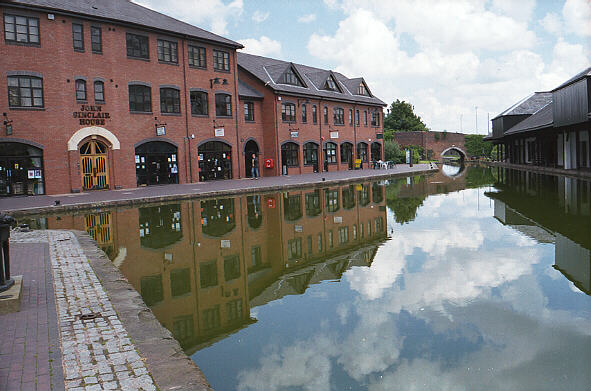
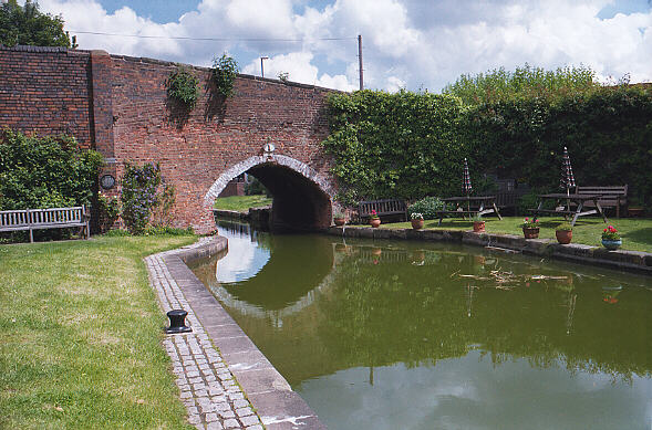
There are shops, a tea room and a delightful garden with benches to rest on at the Canal Basin side of the Drapers Field bridge.
There are many signs, maps and plaques, giving the fascinating history of the canal and canal basin.
Too much information to repeat here.
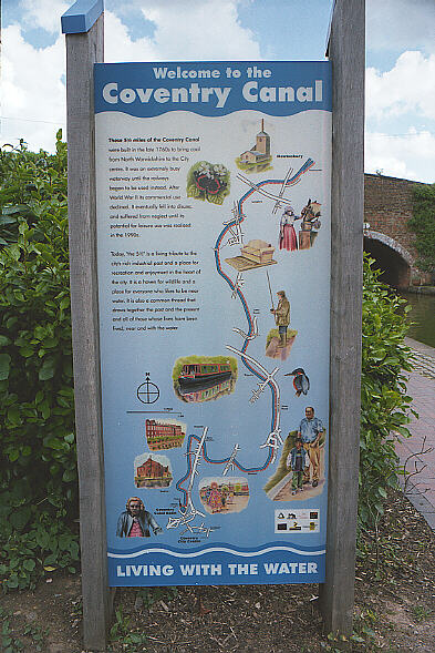
Suffice it to say, the canal was built in 1769 to bring coal to Coventry from North Warwickshire, and it was very busy until the advent of the railway.
POSTSCRIPT
Unfortunately evident thoughout the walk were defaced or missing signs, graffiti and litter. Lots of rubbish was seen floating in the canal. Also, many people evidently think the canalside is a convenient bathroom for their dogs.
All photos were taken with a Fujica ST801 camera and 35mm Pentax Takumar lens, ably assisted by my Gossen Pilot 2 exposure meter.
Please forgive any inaccuracies or misstatements, the above was transcribed from scribbled handwritten notes, many days after the walk. Feel free to email corrections or additional information.
This is the end of my 'Canal Walk' series for now. I hope you have enjoyed accompanying me on these walks and that perhaps you are inspired to make similar walks yourself.
For a glossary of terms, please see Canal Walk I.
No part of these web pages may be duplicated or reproduced without express written consent.
� 2000 David M, All Rights Reserved.