| Cato Falls on the Manitowoc River Manitowoc County Park WI |
 |
 |
 |
 |
 |
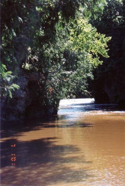
| Cato Falls is located about 8 miles west of Manitowoc, WI. According to the picture's timestamp, I was there 1 July 2001, but I really don't remember why I would be there in July, I should have been busy working up in Northern Wisconsin. A friend took me here, she grew up only a few miles away. The Lower Falls is a County Park, while the Upper Falls are on private land. The water in these pictures is kind of high, but I haven't been back to see what normal flow looks like. Overall, the Lower Cato Falls and the County Park are very nice, and include a trail along the river, parking and picnic areas, and restrooms. I'd like to go back. |
| The Falls are much lower than the surrounding land, as the river has cut across a moraine, so there are a good number of steps linking the Park with the river. |
| Cato Falls are located on the Manitowoc River, which eventually flows thru the City of Manitowoc and out into Lake Michigan. Those are rock outcroppings on the left and right, constricting the width of the river. |
| Lower Cato Falls. Again, I was told the water was a little higher than normal. I do remember some strong storms moved thru the area, dropping alot of rain. |
| Turbulent flow beneath the Lower Falls. |
| A side shot of the River below the Lower Falls of a rock outcropping. |