The following is a step-by-step procedure of an elevation survey:
1. The surveyor gathers pertinent information from the client such as: address, lot, block, subdivision name, description of the building (proposed home on slab, proposed home on pillars, proposed trailer, existing home on slab, existing home on pillars, existing trailer), machinery servicing the building (central air conditioner, sewer pump motor, water heater, washer, dryer, etc.), is there an attached garage, does the home have multiple stories.
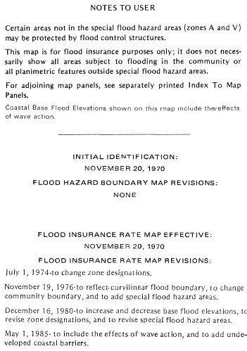
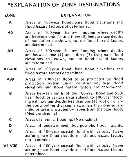
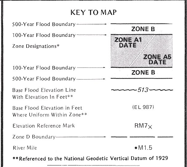
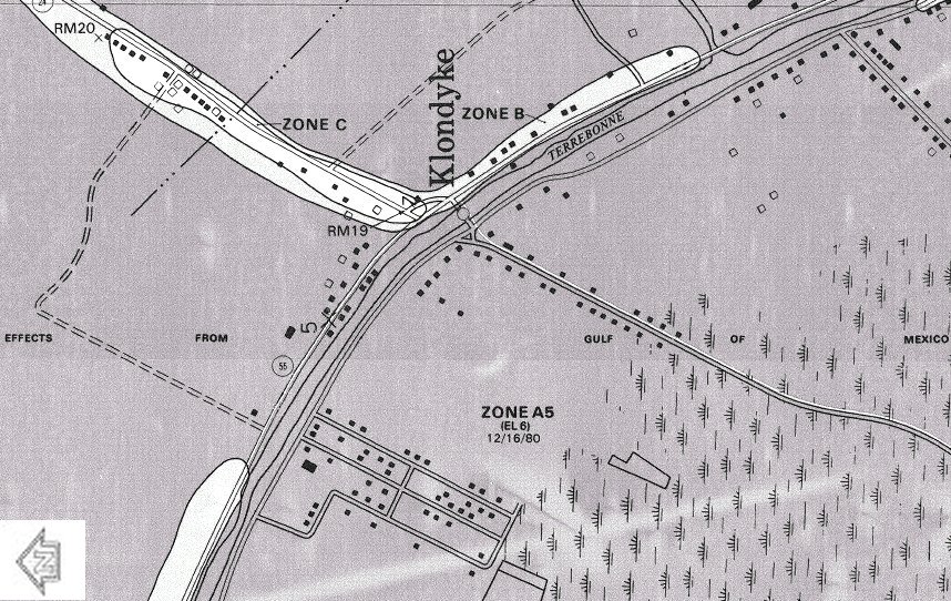
2. Next, the surveyor determines which flood zone the property lies in by using topographic maps and FEMA Flood Insurance Rate Maps. There may be times when a trip to the site is required to determine which flood zone the home falls in (when the home falls close to a zone boundary and the zone cannot be determined by looking at the flood map).
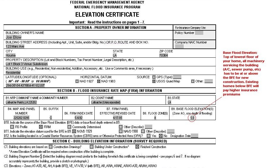
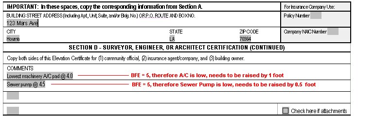
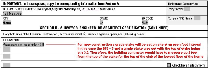
3. Once the surveyor knows which Zone the home lies in, he finds out what the BFE (Base Flood Elevation) is by looking on the Flood Insurance Rate Map. The BFE is the elevation which a proposed home must be equal to or above. For example, if the BFE = 5.0', the lowest floor of the home needs to be built with an elevation of 5.0' or greater. Furthermore, all machinery servicing the building also needs to be at 5.0' or above (such as air conditioner, sewer pump, water heater, washer, dryer, etc.) If it is an existing home, and the lowest floor elevation is lower than the BFE, the owner can expect to pay higher insurance premiums.
4. Next, the surveyor determines what is the nearest elevation survey reference mark to the site. The reference mark has a known elevation which will be used as a starting point of the survey.
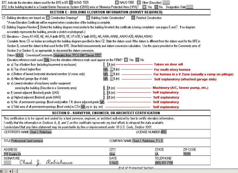
5. Then, the surveyor goes into the field, finds the reference mark, then traverses to the site by transfering elevations to temporary marks along the way (such as nails in a power pole, fire hydrants, wooden stakes, etc). Once the surveyor reaches the site, he takes all necessary measurements (lowest floor elevation taken at door sill, lowest and highest grade, centerline of adjacent road, elevation of all machinery servicing the home, slab of attached garage, next highest floor, lowest horizontal member (in V Zones only), count the number of permanent openings (vents) within one foot of the adjacent grade, total area of all openings (in square inches).
6. Finally, the surveyor traverses back to the starting point to close the loop as a check so that he can verify that the survey was accurate.