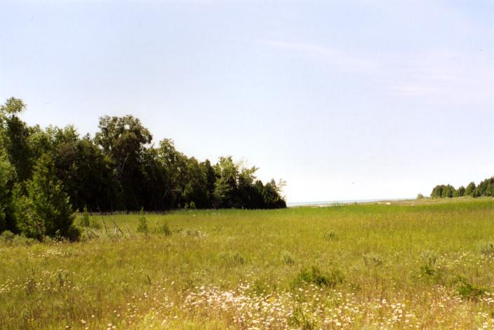
Temperance Island

Rock Garden Between the Islands
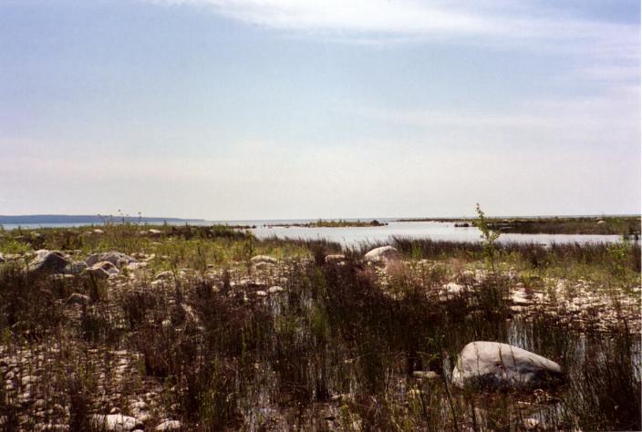
Lost Waterway Dividing the Islands (next to rock in foreground)
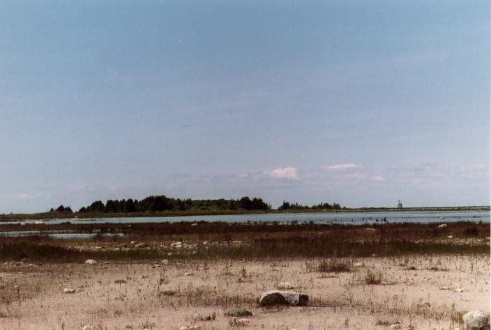
Eastern End of Waugoshance Island
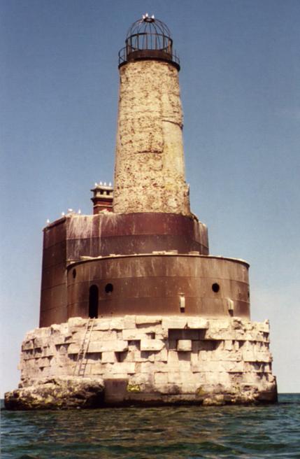
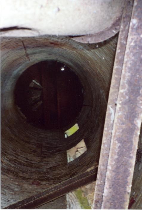
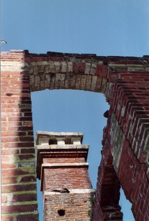
Vienna Shoals Lighthouse
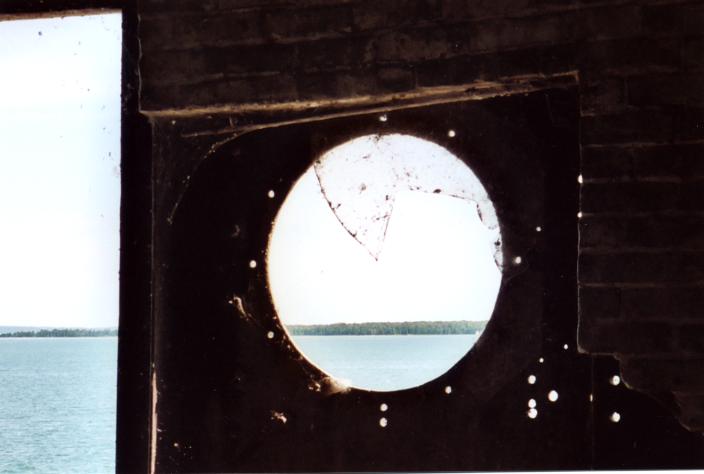
Portal onto Waugoshance Island
Summer 2004 - Waugoshance Island is located in Wilderness State Park on the lower peninsula 15 miles west of the Mackinac Bridge. A wisp of land forms Waugoshance Point followed closely by two mile-long islands, Temperance Island and Waugoshance Island. I paddled Waugoshance Island on three separate day trips from three different launch sites (map).
The first launch site is the lakeside intersection of Lakeview Road and Lake Shore Drive located in the southern end of the park along the belly of Sturgeon Bay. A small driveway off the bend in the road allows access to the water's edge. It's a quaint Canadian-style public boat launch site, meaning there is no cement ramp or any ramp at all for that matter. Locals back their boat trailers right off the stony beach, truck and all, into the lake. This put me 8 miles away from Waugoshance Island, making for an 18 mile round trip. The other launch sites are closer and not usable by boat trailers.
To get to the second launch sites I followed the winding dirt of Waugoshance Point Road thro' the park (permit required) and turned down Sturgeon Bay Road which runs to the south side of the peninsula and Sturgeon Cabin, one of five or six reservable remote cabins in the park. Just before arriving at a gate for Sturgeon Cabin there is a short turnoff out of the tree line to the visible bay. A two-track runs out to a finger of water where I splashed the kayak. After unloading I parked the car out of the way back by the tree line. This site put me 3 miles north of the first site and closer to the island.
The third launch site is 3/4 miles closer yet and is located on the north side of the peninsula. Instead of taking the turnoff to Sturgeon Cabin, I stayed on Waugoshance Point Road. After passing the gate for Waugoshance Cabin, but before the end of the road, there is a short turnoff to the right with a parking area adjacent to the lake. Kayak and materiel have to be carried a short distance to the water. Since it is possible to utilize both sides of the peninsula, I check the wind direction forecast to determine which to use.
Trip #1 - July 3, 2004, late morning from the Lake Shore Road launch I headed out across the bay toward a point on the east side of Goose Bay to cut the distance rather than hug the shoreline. The wind was light and only low frequency waves from the big lake were making their way up from the south. The water reached a depth of 25 feet, but I found a shoal only three feet deep halfway across, one of many nearshore shoals which make the area treacherous to motorboats due to lower lake levels. Paddling was done with care over the shoals watching for near surface rocks. It is impossible to go anywhere in a straight line without crossing shoals. I shot across one shoal into a herd of 80 buffalo carp, the ones that get 4' long and look like a bowling ball head on, in less than 3' of water I could not help thinking, "I need a bigger boat!" But they are very docile fish and only the nearest took any notice. I often saw carp traveling in twos and threes only to look back a while later to see them shadowing the kayak out of curiosity (hunger?). Some of the small rocky islands left by the fallen water level are fostering tern colonies. There are many more terns than seagulls in the area. I passed the navigable passage between Waugoshance Point and Temperance Island called the Big Cut and continued along the south side of Temperance, which like the point is composed of innumerable little coves and nooks which can greatly lengthen a trip. On the east end of Waugoshance Island sits a large 12' high boulder covered with yellow lichen. From its top I could not discern a waterway between Temperance Island and Waughoshance Island. The afternoon wind was freshening out of the northeast and I wanted to ride the following waves counter-clockwise around the island while assuming the south side would provide shelter for the return paddle. I scouted across the neck of the eastern end of Waugoshance Island to make sure there was no posted piping plover area on the other side. I portaged the kayak across the neck over ankle-twisting rocks. Having paddled around the west end of the island I found Mother Nature had other plans and backed the rising wind out of the east. I had to paddle 4 miles straight against soaking 1 1/2' chop - the type of conditions when the slightest break in cadence blows momentum. It didn't let up until deep into Sturgeon Bay passed Goose Bay. Hugging the shore bypassed at the start, I noticed it was all ploverland which prevented a landing to take a break. I continued to the launch site arriving in the evening at the end of an 18 mile paddle. Despite it being a holiday weekend, I only saw one kayaker and one fishing boat near Goose Bay on my way west and not another soul afterward.
Trip #2 - The wind was light late morning at the put in near Sturgeon Cabin. I was hoping the water temperature had risen since my first trip to get the fish in shallow to spawn and afford the opportunity to tangle with a Great Lakes smallmouth. The first trip left me skunked. While headed up the sandy Big Cut I finally spied a smallie but passed it up. Along the north side of Temperance Island I quickly landed a tidy 14" smallie on my light kayakable spinning rig and began sighting much larger ones cruising the shallow rocky shoals. The one I had been waiting for finally rang up and for a few seconds the world was on the verge of ending, but, as it sometimes happens, just as suddenly the lure came free. That was it for me. Later I managed to eek out an 18" freshwater drum, but "eek" pretty much describes drum. Nothing was hitting or sighted along the north side of Waugoshance Island or anywhere along the south side of the islands. The west end of Waugoshance Island looks like a dead zone with a carpet of mush covering everything near shore perhaps caused by the many skittish waterfowl in this area - skittish because there is a big black raptor sitting in a tree top watching all of us. Further out there are interesting bus-sized boulders and bedrock ledges lying in the water, but no fish. I landed on the south side of Waugoshance Island to try to break into the interior. From aerial photography I know there is a pond or wetland inside the island, but getting thro' the tree line is a daunting task. It is thick enough to play handball against. Concertina wire fences around prisons look easier to penetrate ... from the outside. After searching 200 yards of tree line, pushing thro' a gauntlet of spider webs and a spray of mosquitos, and scrambling over and crawling under trees I arrived at a very undisturbed 1 1/2' deep wetland pond stretching thro' a clearing in the trees. Weed filled, but not weed choked. The only thing disturbed was a fox who, becoming curious, poked out of the trees on the opposite side of the pond to see who was making all the racket on its island. Back on the outside, I noticed a strong minty scent from the ground plants near shore. My wet shoes became inundated with oils and rather than reeking as usual became powerful air fresheners on the drive home.
Trip #3 - It should have been hard to top the ick factor of having bare legs covered in spiders and cobwebs as on the last trip. Another late morning launch this time from the north side of Waugoshance Point. It is August; the fish have spawned and left the shallows. I paddle west along the islands taking time to explore the coves between Temperance Island and Waugoshance Island for a hidden passage or determination that the low water levels have joined them into one. I do finally find water flowing between the two islands, but it is far too small and choked with rocks and weeds to float a paper boat, let alone a kayak. Nonetheless, there is a trickle of water flowing from south to north thro' this tenacious gap. Another foot of water may make it navigable, tho' bumpy. From Waugoshance Island I head north 1 1/4 miles to the Vienna Shoals Lighthouse. The dilapidated lighthouse sits atop a crumbling pedestal of stone blocks on a long narrow shoal. It was a trick, but I was able to dismount over a submerged rock in light waves without sucking water. After lifting the yak onto a slab shaped rock next to the pedestal I clamored up a convenient but rickety aluminum ladder and into the brick and mortar steel-clad shell on the west side. The foul stench of decades of decaying seagull guano was powerful. Although they are infrequently sighted everywhere else, gulls are ever present here. Everything was covered in dung and it gives one the palpable sense that everything is covered with the plague and if you touch anything your tongue will turn black. On the two-story east side of the lighthouse, the wooden roof and floors have long since given way and been consumed by decay aided in no small measure by the all powerful white-out. In the middle rises the tower which is filled with tiny flying gnats who take sustenance undoubtedly from some product of the decay and mold covering the walls and floor. The thought of accidently inhaling one of the dirty buggers sends chills of revulsion thro' me. Back outside I notice a shadow drifting from the top of the tower as if a ghostly smoke were rising from a fire hidden deep inside the chimney shaped spire. But it is only gnats, millions of gnats floating out the top and wafting around in the downwind eddy of the tower.