Trip Report #1
Thursday, September 2, 2004 5:30 pm - Push off the beach at Bete Grise to light wind, 1 1/2 foot round waves, sunny skies and haze. Goal: Mouth of Montreal River before sundown, 6 miles. Copper Harbor is an alternative launch site. I counsel against driving back on the Mandan Trail to High Rock Bay or Keystone Bay to launch. The trail is in terrible condition and passable by 4x4 travel only. Smith's Fisheries Trail is in better shape. The proper etiquette is to drive around the back of Smith's Fisheries and follow the trail to its end. If one is unfamiliar with the trails, do not enter them. There is no signage; you will get lost and waste only valuable time if you are lucky.
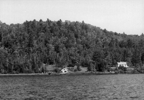
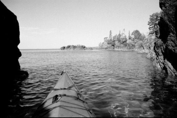
Reflected waves appear strongest near areas of bedrock shoreline and cliffs. Bubbles trailing off the kayak bow have a snappy pop, like water rustling pebbles against each other, a characteristic of the ultra-clean water of Lake Superior. No stops; I easily make the river before sunset. One fishing boat left trolling far out off the mouth of the river. The river water is bracing. Brookies hide in a slot-shaped hole in the falls. Forgoing the hammock, I throw the sleeping pad and bag on the sand next to the kayak and watch the stars. Heavy dew begins after sunset. A small campfire shines on shore toward Smith's Fishery, the only residence along the south shore of the tip. A few fireworks bloom in the far distance. Soon the rising moon fades the stars away. The weather radio gets a good signal with the marine forecast. Weather permitting, the ultimate goal is to circumnavigate Manitou Island lying 3 miles off the tip of the Keweenaw peninsula.
Last year at this same time, I paddled out and camped below the bare hill east of Fish Cove. It was the time of the Marsian invasion when the red planet reached its close approach with Earth. The night was clear and a red glow shimmered eerily across the waters of Keweenaw Bay. Mars has not shone as brightly since 1924 and won't again until 2082.
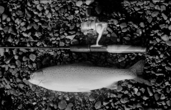
Friday, September 3, mid morning - Push off to clear skies, light southwest wind and waves. Begin trolling a small silver spoon in Fish Cove and get a hit along the rocky point east of the cove - a nice rainbow trout for lunch. At Big Bay I hear an eagle cry and look to shore and see an eagle wearing a white hijab gliding west over another eagle perched atop a pine tree along shore. Big Bay is all pebbles in contrast to sandy Keystone Bay. Take a short floating break in a cove between Big Bay and Keystone Bay.
Somewhere east of Keystone Bay an engine block from a fishing boat rests in the water along shore, a testament to the dangerous storms which whip the lake and the unwary. The engine is a find five or six years earlier on a tortuous hike of the rugged rocky shoreline from High Rock Bay in which most of my toenails fall out. I camped on a small pebble beach then and listened to the lake gurgling thro' the empty cylinders.
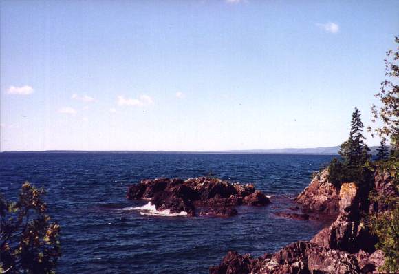
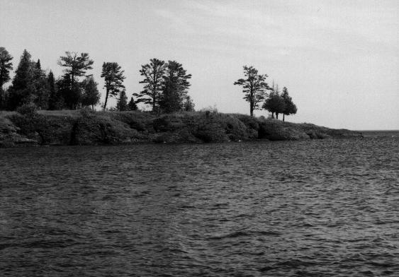
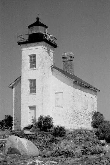
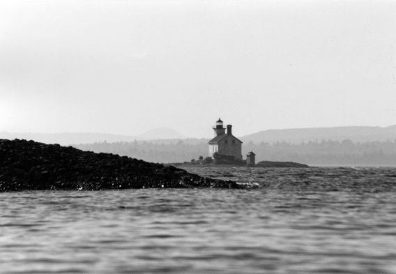
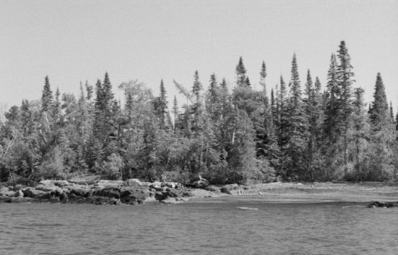
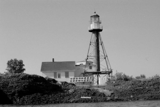
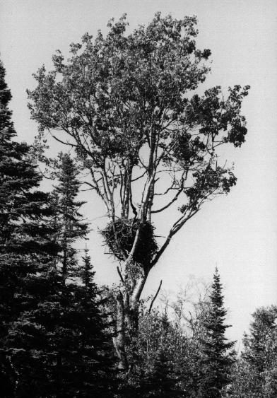
Noon: High Rock Bay and a delicious trout lunch. It is after 1:00 pm before beginning the 2 1/2 mile gap across to Gull Rock Lighthouse. The southwest wind forms a slight jet coming off Keweenaw Point producing a few curling waves to manage from broadside over the second quarter of the distance across. The waves smoothen and the passage eases beyond midway. It takes 40 minutes to reach Gull Rock Lighthouse, and Manitou Island is just 1/2 mile further. I paddle along the north side of the island leeward of the afternoon wind in calm water with the goal of making it around the east end of the island and camp in Fisherman's Bay. A boat is docked in the bay northwest of Manitou Island Lighthouse. Around the lighthouse the water darkens and the bottom drops over 100 feet near shore. Passed the lighthouse a 30 foot high rock cliff runs along for a quarter mile on top of a narrow underwater shelf. Under worse conditions, passing this cliff could be a terrible challenge. It is the only portion of shoreline with no available pull-out. Fortunately the weather is mild today. In one spot a wide seam of bright white calcite slices thro' the bedrock cliff and jags across the shelf under the kayak like a frozen lightning bolt. Fisherman's Bay is made at 4:30 pm. About eighteen miles paddled today. The bayshore stones are sorted beginning with tiny pebbles on its north side progressing meticulously to larger stones and rocks at the south end. Over the years storms have pushed the stones up eight feet high at the tree line and smaller storms have since pushed up narrow platueas at lower levels like tree rings around the bay. A trail leads thro' trees draped in spanish moss in back of the bay. It is a nice spot to hang the hammock up. No one is likely to use the trail. The number of annual landfall visitors can probably be counted on my fingers. Ground huggers have at some time cleared a campsite further north along the tree line, but it is only suitable for a tent. I carry the kayak into the trees to stealth camp. Tho' a couple motorboats pass by the bay, the evening passes quietly. The weather radio still picks up a good NOAA signal. Forecast says mild sunny weather continuing Saturday downgrading to threatening rain late Sunday. That makes Saturday the pull out day.
Saturday, September 4, 10:00 am - Push off from Fisherman's Bay. Weather: A few clouds clearing and light wind. A portion of South Bay has a sandy bottom, the only sand seen since Keystone Bay. I complete the circumnavigation of Manitou Island and make directly for Keweenaw Point rather than High Rock Bay; it is the same distance. The crossing is smoother than yesterday. By the time I reach Keweenaw Point the wind has died. Easy paddling but the sun begins to bake in a black wetsuit. It would have been better to only worn it for the crossing, but I tend to cut across bays over cold deep water. Many fishing boats pouring out of Lac La Belle and trolling far out in the bay. I see other kayakers near Fish Cove, the Montreal River, and Smith's Fishery threading thro' rocks around the shore where motorboats fear to venture close enough to perhaps see the lone, tall purple flower growing up thro' the pebbles on North Bay shore or the flashing talons of the eagles. Without a single break to make a landing I arrive back on the busy beach at Bete Grise at 3:30 pm. Twenty-one miles paddled today. About forty-five miles paddled round trip.
Trip Report #2
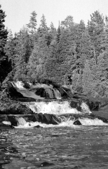
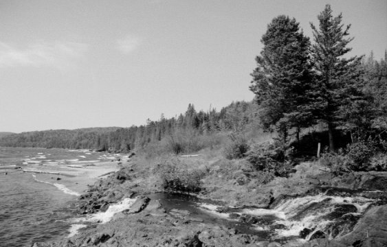
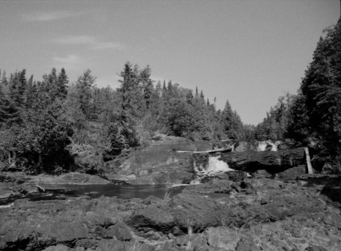
Saturday, September 1, 2007, 8:00 pm - I'm having so much fun today I should be hospitalized. It is late of the same day having paddled Presque Isle and Partridge Island and I pushed off the sandy shore at Bete Grise under a clear sky. Thirty-six hours without sleep, sun setting, headlamp forgotten, and I'm entering some of the most desolate waters on the most infamous of the Great Lakes where making it to a hospital is for the lucky. Low one-foot waves undulated deceptively easy beneath the kayak. A round one-foot wave with a long period between peaks actually contains a huge amount of water and they can be heard and seen crashing with force against the shoreline rocks and bedrock stretching east sending reflected waves back out. I stayed 300 yards out and set bearing midway between Smith's Fishery and the farthest point of land intent on making it to the mouth of the Montreal River to camp. The sun set behind Mount Bohemia before I passed Bear Bluff. The shore was dark and featureless by the time I reached Smith's Fishery around 9:00 pm. The waves were nearing two foot now further away from the protection of Bete Grise. I guessed where the mouth of the river lay along the basic profile of the shadowy shore. I overshot the river, unfortunately, and hit the east side of Fish Cove. I backtracked thro' the sloppy shallows eyeing a couple pebble beaches beckoning me to land and call it a night, but I slowly made it around some rocks and dimly discerned some small white frothing in the consuming dark on the Montreal River falls. The falls are seasonally diminished this time of year and more so now due to drought conditions. Shallows separate a deep pool at the immediate mouth of the river from Lake Superior causing waves to crest outside and allowing an easy landing coming around the east side of the above water rocks off shore thro' the pool and pulling up at the beach on the west side of the falls. Surprisingly, really bafflingly, there were no campers on the bluff beside the falls. This is a popular backcountry site with backpackers who hike the shoreline trail from Smith's Fishery, not to mention kayakers, and since my 2004 visit an ATV trail was knocked thro' the forest making the east side of the falls handicap accessible. Not a soul on a holiday weekend Saturday. I fumbled about in the dark and found two nice cedars I remembered from my last trip here not a stone toss from the falls to tie up the hammock and quickly settled into the dark.
Sunday, September 2 - The wind edged up overnight from the southwest and morning waves built toward a rest day from kayaking. After breakfast I decided to explore the new ATV trail and danced over rocks to the other side of the falls. Three empty campsites mark the terminus of the trail at the river and I quickly saw why this may not be the most popular ATV camping trip. The trail is very narrow and rugged launching up and down steep bedrock and running over innummerable shallow roots since there is precious little topsoil in the area. This has to be the most nausea-inducing ATV trail of all-time. A person could easily hike the winding trail faster than an ATV can travel it, and it looks like a lot of work went into building the trail, but the uneven ground near the lakeshore is pretty unbending - or unlevelable, rather.
Once in the upland the trail picks up some overgrown logging trails and passes thro' hemlock, spruce, birch, and some wetlands. One wetland area had mostly dried up due to drought conditions across the Upper Peninsula this year. Deep cracks fissured the dry mud cake ground except for a small portion of wet pudding in the center. Hundreds of deer tracks dotted the flats. A second wetland still retained open water to support lilypads but was visibly reduced from the surrounding banks. A turtle shell lay upturned on the newly dry flanks.
Returning to the river, the afternoon wind was breezing 25 knots over the whitecapped lake and 4 to 5 foot waves crashed up the shoreline under clear skies. The river washed away the grime from hiking and bushwhacking. Some day-hikers arrived and finally a couple backpackers with two dogs wearing dog-packs showed up. After exploring the falls, they settled at the campsites near the ATV trail. I went to bed and only got up at sunset to cook dinner. The wind had died away and the lake was settling down too. Later, the night stars came out in full and endless display. The Milky Way splashed up sparkling overhead and crashed down into the lake. Meteors swam this way and that. Satellites slowly paddled thro' the stars. In the small morning hours, the rising moon washed the dream away.
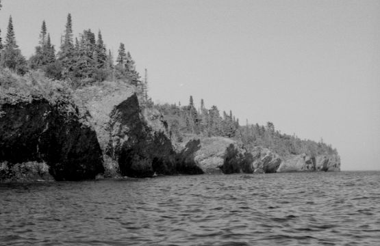
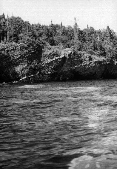
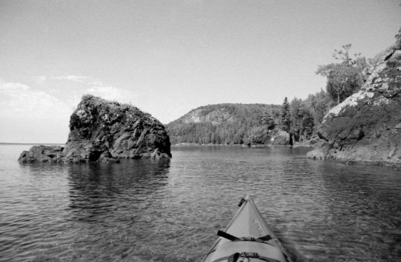
Labor Day, September 3 - The day awoke to a flat lake. The weather radio announced an oncoming thunderstorm thro' Minnesota would arrive in the evening and continue into Tuesday. Wednesday would see winds from the southwest again. I decided to take an easy going paddle out today and end the kayak trip. The calm waters would allow me to hug the shoreline between Smith's Fishery and Bete Grise which I up until had not explored. After loading the kayak I continued heading east thro' Fish Cove. The backpackers and their dogs were loaded up and hiking the shoreline in the same direction. Tough hiking country. The rock garden beyond Fish Cove near the blond-haired boulder is always fun. The geological features along the shoreline are spectacular. Black volcanic bedrock lifts up from the water; streaks of sandstone and calcite run under the water; conglomerate grey and red stones with crystalline foxing sprinkle the shore; the Keweenaw Fault runs up the peninsula and emerges into the lake at the base of Bear Bluff.
An excellent geological explanation of the Keweenaw is contained in the "Self-guided geological field trip to the Keweenaw Peninsula, Michigan," written by Theodore J. Bornhorst and William I. Rose, two professors in the Department of Geological Engineering, Geology, and Geophysics at Michigan Technological University in Houghton, Michigan. This soft-bound field guide can be picked up at the bookstore in the Student Memorial Union building on campus for $30. Well worth the price if only because it points out where you may likely find enough native copper to pay for the field guide and the gas for your trip home to a scrap metal dealer. Aside from that, it provides a good technical description of what you are looking at landscape-wise along the Keweenaw but presupposes some basic geological knowledge on the part of the reader. A good rock book will also be necessary in addition to this field guide since it does not provide graphics or descriptions of whatever one might pick up in hand.
I paddled as far as the west arm of Big Bay and turned around and noticed a white buoy with an orange flag atop bobbing in the water ~300 yards from the western point of Big Bay. The gleam of the sun had hidden the buoy while paddling east. Out at the buoy I found no sight in the depths of what was marked either a wreck or a rock. Neither the wreck of the Langham nor the Mesquite are in this location. Returning to the Montreal River, I found four sea kayaks lined up neatly in a row on shore and one person exploring the falls. That was more sea kayaks than I've seen all year along Lake Michigan paddling 60-70 miles near Manistee, Frankfort and Leland. Thinking back to the last trip here and the groups and numbers of sea kayakers then, the Keweenaw seems by far the most popular kayaking area I've visited so far.
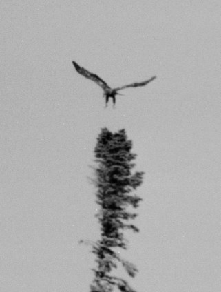
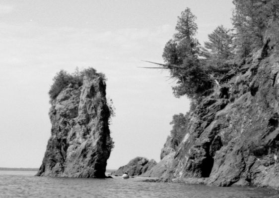
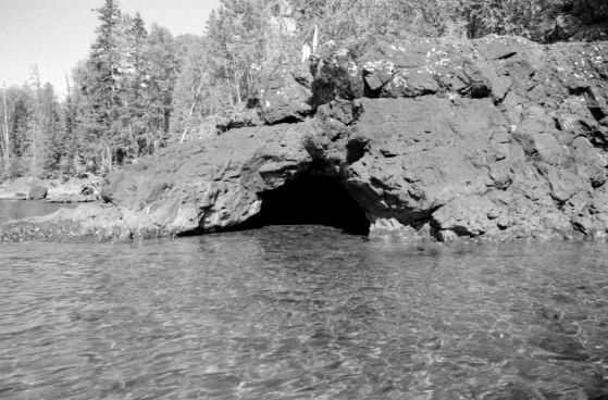
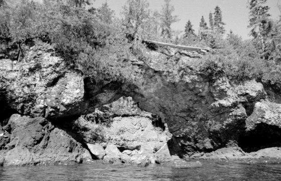
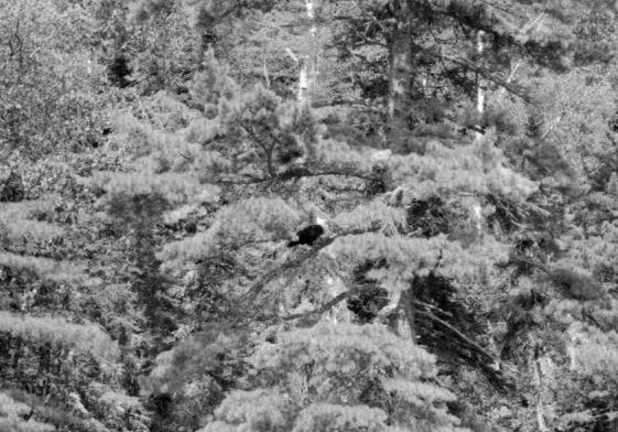
The shoreline geology gets interesting again west of Smith's Fishery and around Bear Bluff with many little nooks formed by water erosion along veins of mineralization in the bedrock. A few form shallow caves perhaps three-quarters of a kayak length in depth at most, but some of the caves are now too shallow or out of the water completely due to historically low water levels in Lake Superior this year. One portal still lies in the water but the west side is blocked by shallow bedrock. Two single sea kayaks and a tandem paddled around the sea stack near Bear Bluff and as they headed toward deeper water a bald eagle skimmed across the water in front of them and landed on the bedrock shore. The kayakers predictably made a beeline toward the eagle as I waited 500 yards east along shore to see if they would disturb the eagle and make it fly my way for a dramatic in-flight photograph with my feeble wide angle lense. The eagle let the kayakers get right on top of it before bolting west - the wrong direction - and rising. A second eagle joined it soaring in from the east high overhead. I gave up wildlife photography and turned back to cave exploring noticing how the warm water in the caves fosters plankton and insect production. Continuing further west I was startled to see one of the eagles had returned to the shoreline rocks 100 yards away, but a small motorboat with a canopy was headed slowly toward us in dangerously shallow water. Sure enough the eagle took off on the boat's approach and headed toward my waiting lense, and as I tensed to snap the photo the eagle dropped its legs and bent its wings to land in a shoreline tree 100 feet directly opposite me. I drifted the kayak to a clear view around some branches, snapped the last photo on the roll, and moved off only to see I was now in the path of the oncoming motorboat, so I bulled my way to deeper water out of their path. On the boat's approach, a couple on a sight-seeing trip, the eagle lifted off again. Just like Rodney Dangerfield, bald eagles, ironically, get no respect. Continuing the paddle I shortly came upon one more bald eagle in a moss-covered spruce along the shore. It would have been another nice photo had I any remaining film. As Bete Grise neared the wind and waves picked up slightly and grey cloud cover began thickening from the west.
******
A map of the miles and miles of public shoreline available for camping. (The map legend needs explanation. The light green and dark green areas are newly purchased state forest land. The hatched areas are owned by The Nature Conservancy. The light blue area is Fort Wilkins State Park. The white areas are private land holdings.)
Aerial photo of the Keweenaw Tip and Manitou Island. (I carried print-offs of these photos in my PFD pocket, including zoomed in portions of the shoreline and high magnifications of the west half and east half of Manitou Island.)
A map of Manitou Island showing the state forest land available for multi-day camping. The rest of the island is owned by the federal government with the lighthouse managed by a conservancy.
|