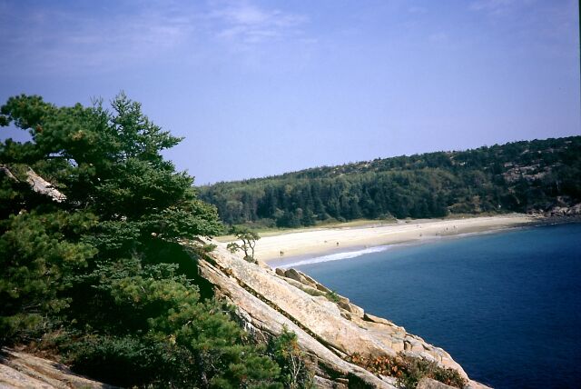
Day 48 Acadia National Park ME, 02.10.02 44°30'N 68°W GMT-4 13.790 km from Mainz
Mountainbike-Tour durch mediteranes Klima in Maine, dem 'Pinienbaum-Staat'
Mountainbike trip in mediteranean climate in Maine, the 'pine tree state'
 United States of America (East & Central)
Day 48 Acadia National Park ME, 02.10.02
44°30'N 68°W GMT-4 13.790 km
from Mainz
Mountainbike-Tour durch mediteranes Klima in Maine, dem 'Pinienbaum-Staat'
Mountainbike trip in mediteranean climate in Maine, the 'pine tree
state'
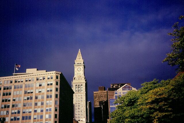
Day 49 Boston MA, 03.10.02 42°20'N
71°W GMT-4 14.270 km from Mainz
Metropole in Massachusetts - "The Spirit of America" - Hier wurde
der Grundstein zu den Vereinigten Staaten gelegt und daher trägt der
Staat diese Bezeichnung
Metropolis in Massachusetts - "The Spirit of America"- here
the American nation was born in the late 18th century and therefore the
state got its nickname
Day 51 Burlington VT, 05.10.02
44°30'N 73°10'W GMT-4 14.670
km from Mainz
Zurück in der amerikanischen Provinz in Vermont dem "Green
Mountain State"
Back in the American province in Vermont, the "Green Mountain State"
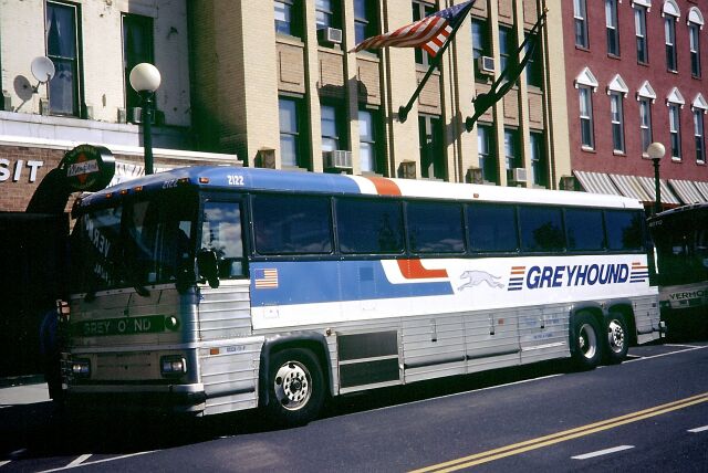
Day 52 somewhere between Burlington VT & Albany
NY, 06.10.02
Eine amerikanische Institution, der Greyhound Bus. Mit ihm reiste
ich mehr als 11.000 km von Maine nach Kalifornien
An American institution, the Greyhound bus. With the 'dog' I traveled
more than 6.800 mi. from Maine to California
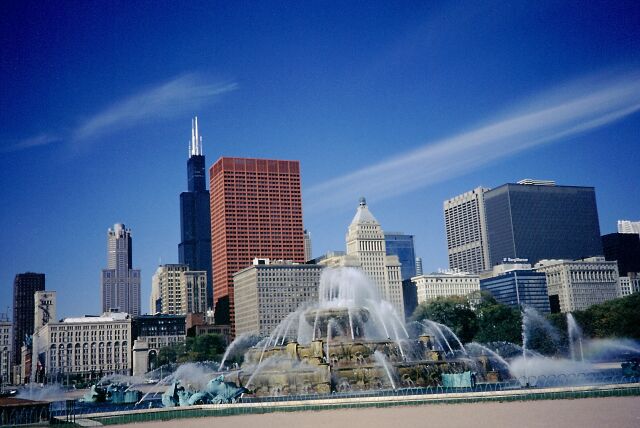
Day 54 Chicago IL, 08.10.02
42°N 88°W GMT-5 16.361 km from
Mainz
Geschichte und Moderne in Illinois Metropole vereint
History and modern times united in the metropolis of Illinois
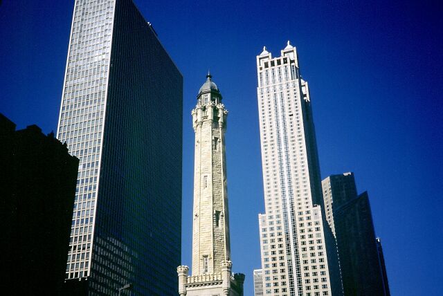
Day 54 Chicago IL, 08.10.02
42°N 88°W GMT-5 16.361 km from
Mainz
Der Sears Tower (schwarz) ist der höchste Wolkenkratzer der
USA und weit höher als das frühere World Trade Centre in New
York
The Sears Tower (black) is the highest skyskraper in the United
States and much taller than the former World Trade Centre in NYC
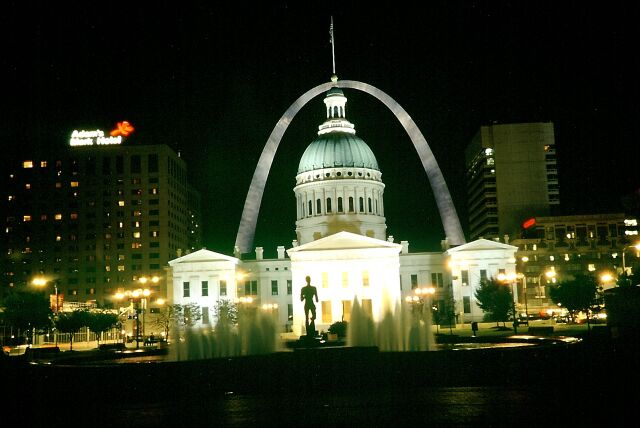
Day 55 St. Louis MO, 09.10.02
38°30'N 90°W GMT-5 16.843 km from Mainz
Das 'Gateway to the West' am Mississippi gelegen, markierte früher
das Ende der Zivilisation und den Beginn des 'Wilden Westen'
The 'Gateway to the West' situated at the Mississippi was in former
days the border between the civilisation to the east and the lawless wild
west in the oposite direction
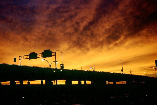
Day 55 St. Louis MO, 09.10.02
38°30'N 90°W GMT-5 16.843 km from Mainz
Autobahn nach Westen
Interstate to the West
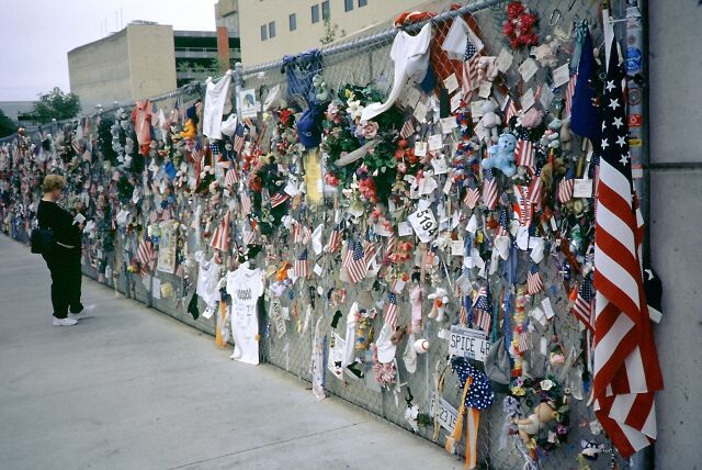
Day 56 Oklahoma City OK, 10.10.02
35°10'N 97°W GMT-5 17.773 km
from Mainz
Nationales Gedenken an die 168 Opfer des Terroranschlags am 19.
April 1999
National Memorial for the 168 victims of this terrorist attack on
April 19, 1999

Day 58 Dallas TX, 12.10.02 32°30'N
96°50'W GMT-5 18.218 km from Mainz
College Football Fans der Oklohoma Universität (OU) beim Spiel
gegen die Longhorns aus Texas
OU College Football fans during the match against the Texas Longhorns
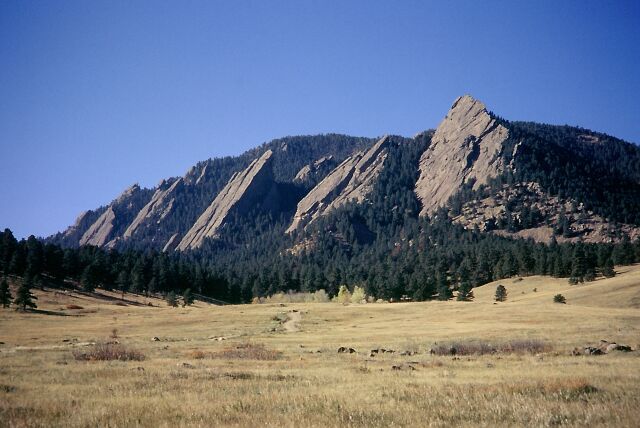
Day 60 Boulder CO, 14.10.02
40°N 105°W GMT-6 19.653
km from Mainz
Die 'Flat Irons' eignen sich prima für eine Herbstwanderung
in den Rocky Mountains von Colorado
The 'Flat Irons' are ideal for a hike in fall in the Rockies of
Colorado
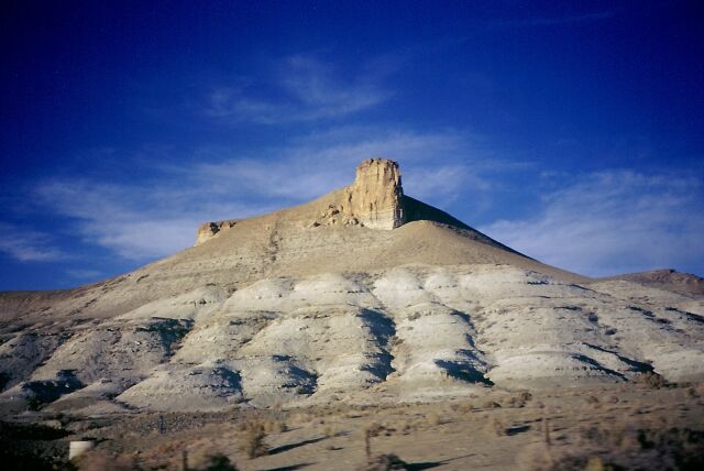
Day 61 on the road between Colorado, Wyoming and
Utah, 15.10.02
834 km von Boulder, CO nach Salt Lake City, UT mit dem Greyhound
durch Amerikas wüstenreiche Landschaft
517 mi. from Boulder, CO to Salt Lake City, UT with the 'dog'
through Americas' dessertlike landscapes
Reise fortsetzen?
Continue your trip?
Continuer ton voyage?
¿Quieres continuar tu viaje?
Nach Mainz zurückkehren?
Do you want to go back to Mainz?
Tu veux rentrer à Mayence?
¿Quieres regresar a Magunca?