 Chesler's Home Page Chesler's Home Page
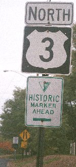 This is an historic marker marker. I suppose that in the future such signs will be pointed to by historic marker marker markers. (Java does not support pointers.)
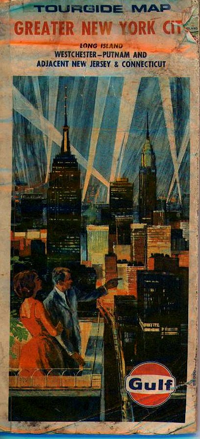 This is just the cover to a map that my father always had lying around while I was growing up, but it was the image I always had of what my life would be like when I grew up. Here is an attractive, well-dressed couple, undoubtably optimistic (what's he pointing to?), the world their oyster, out for a night on the town. It's not exactly how things turned out.
Where is that old optimism? Where's the everyday vaporware?
The illustration was from the same time period that gave us the World's Fair, with its products and kitchens and houses and interstates of tomorrow. Today, with no cold war, all we have to look forward to is the Y2K bug. (It was used through at least the 1974 printing date of the map.)
Even this web site, Heartland/2955, shows nostalgia two ways. First, I don't really live in any Heartland. I live in an old industrial suburb, home of the country's third-largest Superfund toxic waste site (although even moving to suburbia to raise my kids is a throwback for a city boy like myself.) And even the address is fake. The 2900 block of the Heartland virtual neighborhood was first filled probably two years ago, a lifetime on the Web. Rather than move into a shiny new virtual address in some subdirectory, I had to wait for a vacancy, and moved into this previously-owned URL.
I understand that some people call my cohort, those born in the years 1960 through 1965 "Tweeners" -- that is, between the real Baby Boomers and the so-called Generation X. Our experiences don't match either of those generations. At the early end, we are too young to remember Howdy Doody or the assasination of President Kennedy; Woodstock and Vietnam were of little concern to us. Later on, we grew up with "Sex and Drugs and Rock and Roll" but we came of age during the time of Reagan and AIDS.
(The owner of this map was just a few years too young to fight
in WWII, and served during the "forgotten" Korean conflict instead. I'm sure there's a connection.
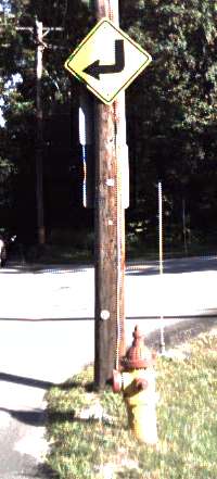
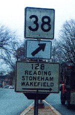 This sign is ambiguous. It is found just east of Winchester
Center, on what is currently Massachusetts State Route 38, but
Route 128 is no where near there. The 128 sign is old, and
the sign may be saying that 128 may be found in that direction
(north.) In fact the Washington Street interchange is about
four miles north of that spot, in Cummings Park, East Woburn.
At one time I thought this might have been the path of Route 128 before
the Circumfrential Highway was built in the 1950s, but even
then Route 128 was about three miles north of there, running
along Montvale Avenue. I wonder if Route 38 used to run through
Winchester Center, crossing the Aberjona River south of it.
This sign is ambiguous. It is found just east of Winchester
Center, on what is currently Massachusetts State Route 38, but
Route 128 is no where near there. The 128 sign is old, and
the sign may be saying that 128 may be found in that direction
(north.) In fact the Washington Street interchange is about
four miles north of that spot, in Cummings Park, East Woburn.
At one time I thought this might have been the path of Route 128 before
the Circumfrential Highway was built in the 1950s, but even
then Route 128 was about three miles north of there, running
along Montvale Avenue. I wonder if Route 38 used to run through
Winchester Center, crossing the Aberjona River south of it.
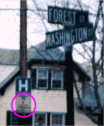 This sign, about a mile north of the prior one, in Winchester Highlands,
at the intersection of Washington Street and Forest Street (near
Winchester Hospital, but the local landmark is the Gingerbread House;
there is also an historical marker there from the Massachusetts
Tricentennial Commission [1936] indicating that this land was once
owned by John Harvard and bequeathed to the college that bears his
name.)
This sign, about a mile north of the prior one, in Winchester Highlands,
at the intersection of Washington Street and Forest Street (near
Winchester Hospital, but the local landmark is the Gingerbread House;
there is also an historical marker there from the Massachusetts
Tricentennial Commission [1936] indicating that this land was once
owned by John Harvard and bequeathed to the college that bears his
name.)
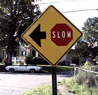
This sign is less ambiguous. I apologize for the quality of the
image, but the sign says "128 this way [ahead], Stoneham and
Wakefield make a right" (I guess they've forgotten about Reading.)
There is no way this sign means "You are on Route 128 towards Stoneham
and Wakefield", so I guess it's pointing either to the "new" Washington
Street interchange, or simply to Montvale Avenue.
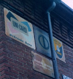 I noticed these old credit card signs on the side of the building
occupied by Precision Engine Rebuilding, Somerville Avenue and Dane
Street, Somerville, Massachusetts. (Between Porter Square and
Union Square; Dane Street provides an alternative to Park Street
for getting south to Beacon Street/Hampshire Street and Inman
Square Cambridge.) The building is currently for sale, so visitors
should hurry.
I noticed these old credit card signs on the side of the building
occupied by Precision Engine Rebuilding, Somerville Avenue and Dane
Street, Somerville, Massachusetts. (Between Porter Square and
Union Square; Dane Street provides an alternative to Park Street
for getting south to Beacon Street/Hampshire Street and Inman
Square Cambridge.) The building is currently for sale, so visitors
should hurry.
Unicard became BankAmericard in the late 1960s I think, and then became Visa in the mid 1970s.
The second sign is for Diner's Club (not Civil Defense).
The third sign is for American Express -- I don't know when that logo was used.
The sign on the bottom row is for MasterCharge, which became MasterCard soon after BankAmericard became Visa.
The sign on the lower right of the picture references a local hospital.
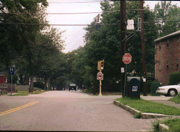 What does it mean when there is both a stop sign and a
traffic light at the same intersection?
What does it mean when there is both a stop sign and a
traffic light at the same intersection?
This picture is not an illusion. It is the view in Stoneham, Massachusetts, heading north on North Border Road across Marble Street, as it becomes Park Street, between I-93 (just north of Exit 35) and Main Street.
A few miles west the same situation used to exist in Woburn Center, from Salem Street to Main Street.
And except that a truck hit it before I could take a picture,
Wood Street, coming from
Salem Street, had a 30 mph sign on the right side, and
50 yards further south a 25 mph sign on the left side.
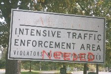 And this time they really mean it!
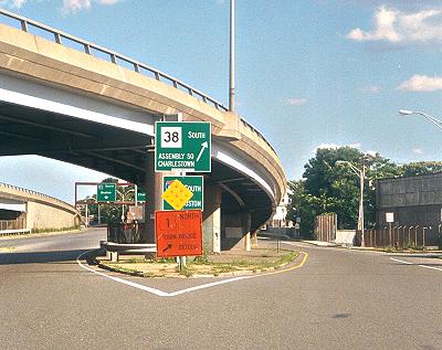
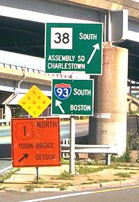
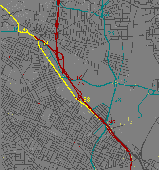
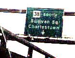 ends just north of where McGrath Highway crosses under I-93. As I posted in
ne.transportation on April 21, 2000
in that newsgroup this signage shows Route 38 existing south
of there, and continuing. See also the small image of the exit
sign a little further south on I-93, which implies that Route 38
continues down Mystic Avenue, and past the merge with Broadway
at the Mt. Vernon down Maffa Way, to Sullivan Square.
ends just north of where McGrath Highway crosses under I-93. As I posted in
ne.transportation on April 21, 2000
in that newsgroup this signage shows Route 38 existing south
of there, and continuing. See also the small image of the exit
sign a little further south on I-93, which implies that Route 38
continues down Mystic Avenue, and past the merge with Broadway
at the Mt. Vernon down Maffa Way, to Sullivan Square.
What's not made clear, even if a driver sees the entire sign, is that if one does go left, the next exits are on the far side of the Charles River (either the Leverett Connector, or the Lower Deck) which are usually 15 to 30 minutes of traffic away.
Here, and not in a place where locals don't like transients driving through, would be a good place for a "Last Exit to Cambridge" or "No Re-Entry" sign.
|
Site: |
This page: |
Site: |
|
|
||