The climate of Guanajuato is mild, not too hot or too cold. Some people say that the climate of San Diego, California is the best in the United States. In the coldest month the average temperature in Guanajuato is a couple of degrees warmer than San Diego and in the warmest month the temperature of Guanajuato is a couple of degrees cooler. The warmest month is May and the coldest month is January. Although a good part of the year is dry in Guanajuato, the annual average rainfall is 29.15 inches but that is an average and the variation can be considerable. The rainy months are June through September with each month receiving on the average more than five inches. To see charts of temperatures and rainfall click on GTO Climate.
For todays weather in Guanaujato click on
Weather. Use Back Button to return.
Guanajuato is located in the Sierra de Guanajuato mountains part of the Sierra Madre, a hugh mountain chain running through much of Mexico. Our house is at an elevation of 7,000 feet.
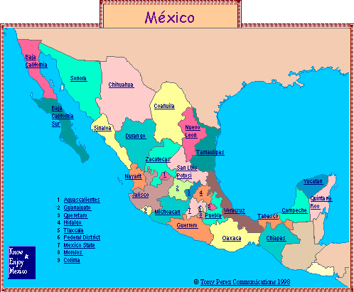
Guanajuato is a small state, Number 2 on the map and shaded light green, just east of the State of Jalisco and north of the state of Michoacan in the center of the country. The city of Guanajuato is 580 highway miles south of Laredo, Texas, 227 miles north of Mexico City, and 184 miles west of Guadalajara which is Mexico's second largest city.
 Return to homepage