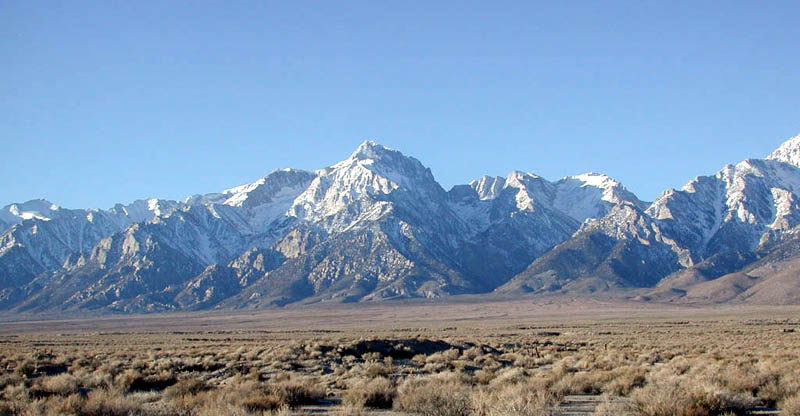
Mountains: Mt Williamson (14,375 ft) and Mt Tyndall (14,018 ft).
Trip date: July 13-15, 2002 (3 days). Alpine style.
Climbers: Miguel Forjan, Mike Ostby
Went with partner Mike Ostby. Hiked most of the day on Saturday, July 13th. After Shepherd's Pass, we set up camp near the 2nd lake at ~ 12,500 ft. Next day (Sunday, July 14th) we got an early start to cross the Williamson Bowl. Got below to the beginning of the climb (West face route) at 7:00am (below the black stains). My partner, Mike, turned around at this point because of fatigue and exhaustion from the previous day. I continued on and reached the summit at 8:57am. I stayed nearly an hour on the summit having an early lunch and talking to the 3 other climbers up there. I hooked up with one of them (Shasha from the Ukraine) for the descent and to swap cameras for picture taking. Got back to camp, rested for 2 hours and then headed to summit Mount Tyndall via the North Rib.
Mount Tyndall via the North Rib:After summitting Mt Williamson in the morning, I got back to camp around 1:00pm after crossing all that talus on the Williamson Bowl. While resting on our high camp, my buddy Mike convinced me to attempt Tyndall that same day. I rested for 2 hours and then at 3:00pm I started hiking towards the North Rib. Got off route 1/2 way up. I ended up further north (climber's right) on the ridge by a small gully. I had to do some class 4 sections with exposure. Now I know when people say your adrenelin is pumping. Finally managed to cross this hairy section for me on the ridge and dropped down a bit to the right (west) to connect with the NW ridge route. I reached Tyndall's summit at 4:19pm. Stayed there only 5 minutes. By the way, all the summit registers up there are full. I was able to find the correct North Rib route for the descent. Got back to high camp at 5:30pm. Hiked out next day (Monday, July 15th) at 7:00am from high camp. Reached the Shepherd Pass trailhead parking area at 11:30am. Was home in L.A. by 4:00pm.
Friday evening, July 12: Drive to Independence, CA and sleep at the trailhead parking area.
Saturday, July 13: Drive to the Shepherd Pass (Symmes Creek) trailhead. In order to get closer to Mt. Tyndall and Mt. Williamson, I was thinking we should continue hiking past Shepherd Pass (trailhead to Shepherd Pass ~ 10 miles) and make our camp in the vicinity of Williamson Bowl (elev: 12,200 ft). Williamson Bowl is a large basin with four lakes. By camping near the Bowl, we'll be able to climb both Williamson and Tyndall on consecutive days.
Sunday, July 14: Climb Williamson via the West Face (class 3). Descent the same way. Relax at camp.
Monday, July 15: Climb Tyndall via the North Rib (class 3). Descent the same route. Break camp, pack up, and return to our cars. Stop and eat in Lone Pine. Drive home. End of trip.