Alta Peak (11,204 ft / 3415 m): via Alta Peak Trail

June 8, 2002

Alta Peak (11,204')
Snow-covered Alta Peak (11,204') as seen from Moro Rock.

Will and I day-hiked to the summit of Alta Peak (elev: 11,204') on Saturday, June 8, 2002. We camped Friday night at Lodgepole campground in Sequoia National Park.

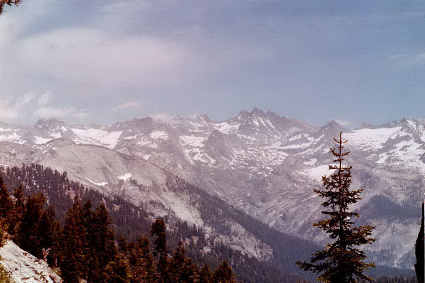
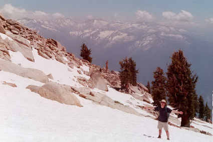
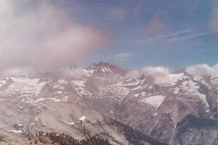
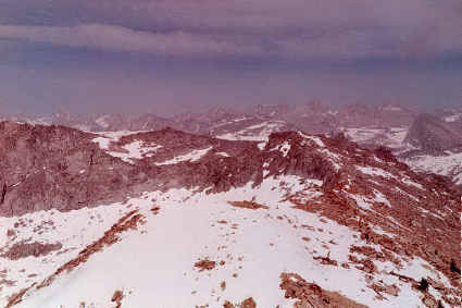
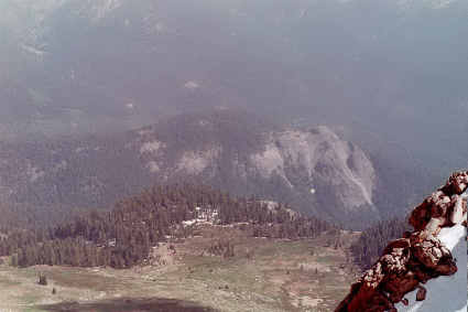
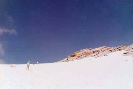
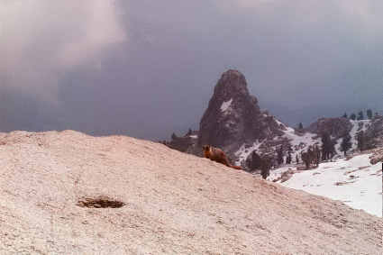
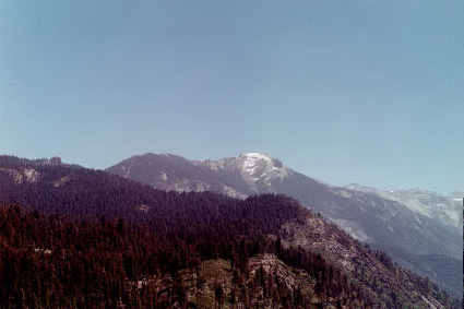
Saturday morning we drove to Wolverton trailhead (elev: 7250') and hit the trail. In about 3 miles or so, you reach Panther Gap, which reward you with good views of the Kaweah Canyon and the Great Western Divide. The last 800 vertical feet there was sun-cupped snow. We were greeted at the summit with a bunch of marmots (I saw at least 4 or 5 of them). Fog started to roll in and that's when we started our descent. Got back to the trailhead uneventful.

Some pictures from the Alta Peak trail hike:

The Great Western Divide as seen from Alta trail

Will approaching Alta Peak summit

Will on Alta Peak's summit

Yours truly on Alta Peak's summit

The Great Western Divide from the top of Alta Peak (looking east)

NE view from Alta Peak's summit
Northeast (NE) view from Alta Peak's summit

Alta Meadows below
Alta Meadows below

Descending the snow slope just below Alta Peak's summit

A hungry marmot on Alta Peak's summit (Tharps Rocks behind marmot)
A hungry marmot on Alta Peak's summit (Tharps Rock behind marmot)


Return to my mountaineering page.

Last Update: October 3, 2002
By Miguel Forjan
Email: [email protected]
Hosted by www.Geocities.ws

1