La
Paz is the most bizarre city I have ever seen.
One is trundling along the altiplano at 4,000m above sea level when the
earth falls away in a large steep-sided valley in which there is a bustling
city in every direction. Unlike every
other city on earth, the posh part is the lowest part as this is where there is
actually some air. Bolivia is about
South America’s poorest country but La Paz is a hive of activity with street
vendors selling everything from Minidisc players, through hairdryers to all sorts
of foodstuffs. However, there are some
major differences to other parts of the world:
outside your average Natwest there is not normally a security guard
standing holding a pump-action shotgun.
Great for deterrent but not exactly designed to minimise collateral
damage in the event of an incident.
La
Paz has a bizarre public transport system consisting mainy of an armada of
unregulated microbuses, which charge around screaming out in Spanish where they
are going and touting their prices.
There are no stops, you just flag them down. The general rules of the road are somewhat more opaque, with the
general rule appearing to be that one assumes that there are as many lanes in
the road as vehicles will fit, plus one.
This obvious paradox is then resolved through tooting, shouting and
bluff. However, despite the rather
frightening appearance, there are few crashes and most vehicles do not show
signs of many collisions.
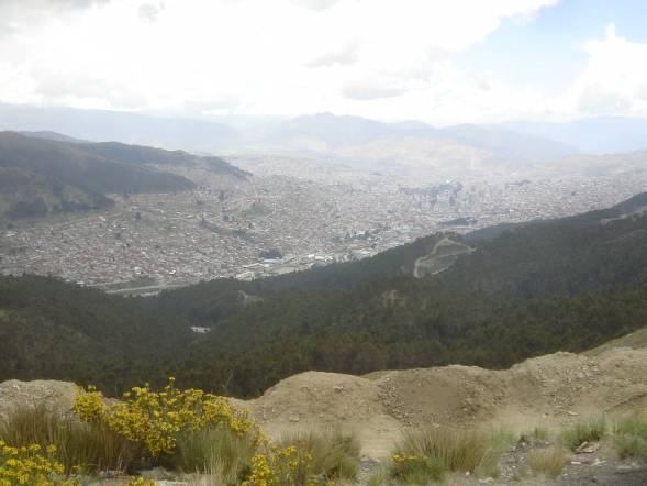
[La Paz from the edge of the valley rim]
The
highlight of our La Paz experience was our decision, based upon several
recommendations, to charter a taxi to take us up Chacaltaya, the 5,400m
mountain immediately north of the city.
After an extended bargaining in the mutual language of typing things on
a mobile phone we set off. For some reason,
we were doing this (half-day) trip in a morning where it was imperative that we
were back quickly to catch a bus.
Things soon looked a bit grim when the driver pointed out a large
thunderstorm on the mountain itself.
They became grimmer still when we went through a serious hailstorm, but
these problems were quickly put into perspective when acrid smoke began pouring
out of a mass of wires hanging loose from where the dashboard might be on a
normal car. I have never seen Jon move
faster than as he leapt out once we had stopped but the driver looked at him
oddly and began poking around the wires with his fingers. After 5 minutes of twisting and tweaking he
profferred “Está bien” and indicated that we could carry on. We established from him that it was only the
electrics and that it had happened before so we need not be worried. Obviously.
We were also rapidly approaching the middle of nowhere so there was no
point in worrying and off we went to the approach road.
‘Road’
is probably the greatest compliment the route has ever been paid, for it
actually consisted of packed scree and puddles from the hail. It had been warm in La Paz but as we got
higher a familiar foreboding arrived.
Yes, just like in west Canada, central Canada, east Canada, east USA,
central USA, west USA and Peru, we were getting snowed on but just as things
looked truly uncontinuable (snow and lightning are not generally a good
combination when in a metal box on a large mountain), the storm headed off for
its customary afternoon appearance over La Paz and left us in clear
weather. I should point out to any
skiers reading this that I am heading to Lech next year at the end of March and
therefore I can assure you there will be lots and lots and lots of snow!
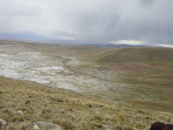
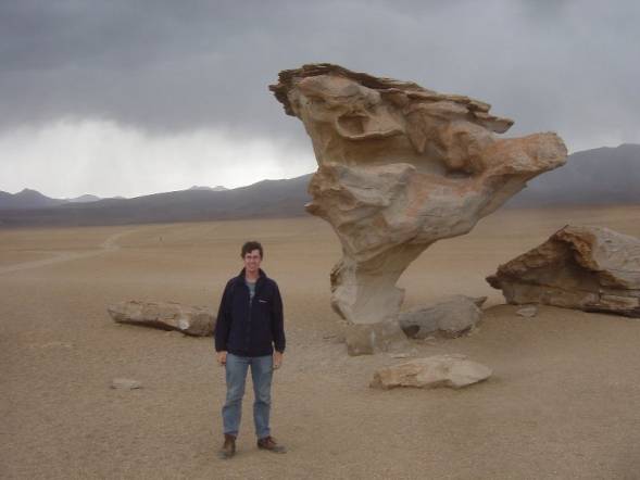
[The bane of our trip, more fresh snow, but look at the
cool red rocks!]
Once
the taxi had defied science and made it to the top, we were left with the
simple task of hiking up the last 150m or so to the summit. The air up here is only 50% of sea level so
it is actually bloody hard work and, pleasingly, even the young taxi driver was
panting. The views from the top,
however, are amazing with colourful oily lakes, other mountains and La Paz
itself visible. It is also quite cool
to be at practically 18,000 feet, nearly 4 times the height of Ben Nevis and
well above Mont Blanc.
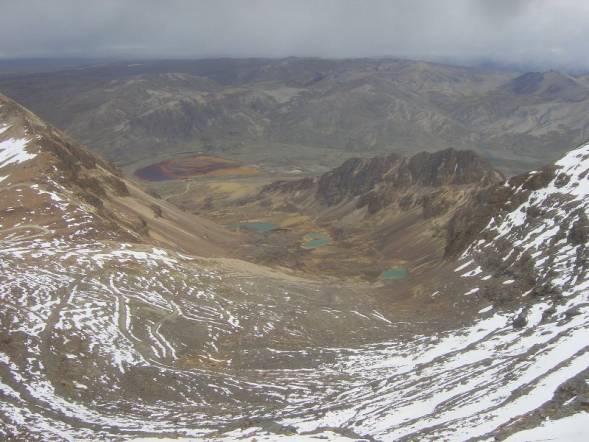
[View of lakes from 5,395m the top of chacaltaya!]
We
made it back to the bus in time, but not before some brief thrills as the taxi
driver lost the back end at 80kph on the wet scree. The first bus (to Oruro) was moderately comfortable but stopped
to pick up anyone who the driver thought might give him an extra boliviano and
we had a rather rushed connection to the overnight Uyuni bus. Most of our bus journeys had been
surprisingly comfortable but things were about to change. We said goodbye to our backpacks as they
were tied to the roof with string alongside the various chickens, vegetables
and God knows what. First prize for
God-knows-what-ness, though, went to a pair of Victorian-style leaf springs,
presumably intended for some long suffering vehicle long past its original
suspension´s life. Or mybe they were
spares for the bus.
On
board the 50 seat bus there were some 80 people. I imagine that the people lying in the aisles had paid a bit less
than those seated but I can´t be sure.
The road to Uyuni is unpaved and unlit and we had a few unscheduled
stops in unelectrified mudbrick villages but the driver stil managed to coax
his overladen bus there some 2 hours early, thus allowing us to find
accommodation for the last part of the night and get some sleep. Our backpacks even made it as well. Our accommodation turned out to be part
hostel, part brickworks and in the morning a few glares were elicited as the
size 12 footprint across a couple of the drying bricks showed itself. Ooops!
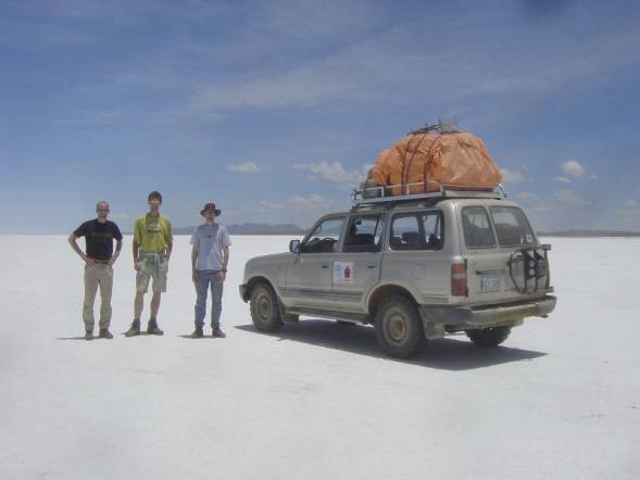
From
Uyuni, we were booked onto a 3 day Land Cruiser tour around the altiplano
(literally ‘highflat’) of southern Bolivia.
This is where the basic floor level has ended up at 4,000m and the
volcanoes etc. rise out above this.
Very strange. Day one takes you
into the salar de Uyuni a 12,000 km2 dried salt lake that is visible
from the moon. Unsurprisingly it is
fearsomely bright white. The water
table is in fact at the surface level – any indentation slowly fills with
water. In the middle of this are some
‘islands’ covered only with cactuses and they become actual islands when the
thing floods in the wet season.
[White all around, and this time it’s salt!
NB taken with 1/2000
second exposure and still bright]
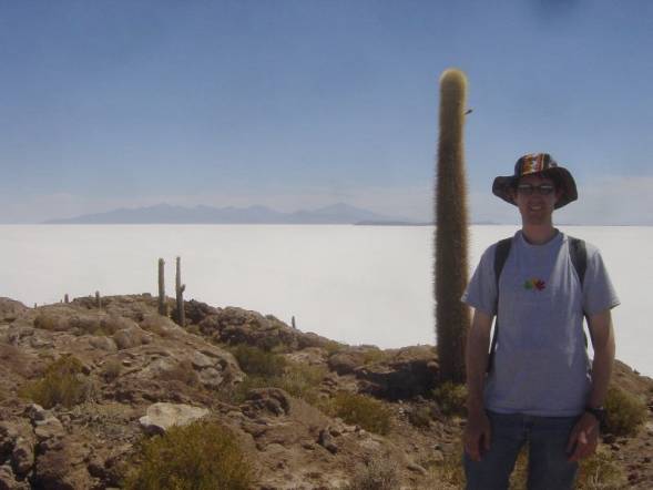
[On the Isla del Pescado with a large cactus]
That
night we stayed in a hamlet called San Juan.
It did however have a couple of bars, although we were the only
patrons. We had selected our bar based
upon the cheesy 80’s music emanating but were disappointed when the power went
out at its allotted hour. This, howeve
is Bolivia and the old woman running the place pottered around with wires and
whatnot and successfully got the stereo back up and running from a spare car
battery lying around. Magic.
The
next day took us across some desert landscapes, with the most bizarre rock
shapes. These were at 4,000 – 4,500m
and the whole vista is like something from Mars. Desert or no desert, we weathered the now obligatory brief
sleet/snowstorm and admired some spectacular lightning before coming across a
series of sulphurous lakes complete with flamingoes.
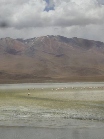
[flamingoes and a yellow lake (which stank!)]
[I’ve landed on Mars!
Note snowstorm approaching in background]
In
the late afternoon and after a few comical races with another tourgroup we
reached our destination, Laguna Colorado.
This is a fabulous location with a small settlement alongside a lake,
where the water is brick-red. There are
deposits of white borax along the edge of the lake and a towering volcano looks
over the whole thing. If it had stopped
sleeting and the sky has been blue it would probably have made the best scene
I’ve ever seen but it was still pretty awesome with the grey sky.
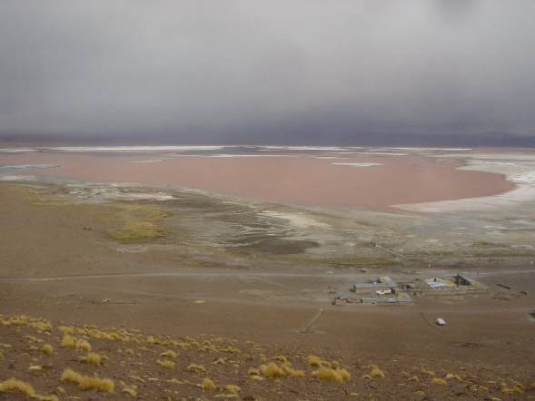
[Laguna Colorado taken from ridge at 4,400m. ‘village’ is visible in foreground]
Day
three saw another 5am start but this was to be well worth it. First stop was a series of geysers and
mysterious bubbling mud ponds occasionally spitting globules of it out of their
craters. Like much around here, the
steam’s activity was the closest thing to life but the rocks are a fabulous
array of reds, yellows, browns and whites.
The second stop was at a hot spring that is at the perfect temperature
of 38 degrees. Our early start came in
handy as we were able to grab the prime spots before a couple of other Land
Cruisers arrived. The air was cold, the
water was warm and the sun shone down as we were served breakfast in the
springs. Heaven. This is a good example of how it sometimes is worth getting up early.
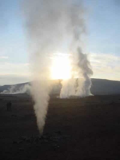
[Geysers at dawn]
Another
trip past more volcanoes, some of which were showing impressive hints of
activity, brought us to Laguna Verde.
Whilst Laguna Colorado is impressively red, those of you with a modicum
of spanish will be able to guess that this lake is impressively green. It, too, has a cool volcano backing behind
it.
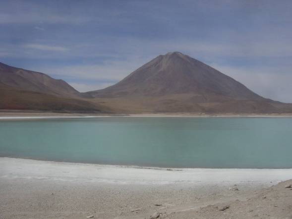
Llaguna Verde. Behind Volcano is Chile. Behind camera is Argentina]
Alas,
that was all we had time for in Bolivia before heading towards the Chilean
border. We said goodbye to our driver
and our cook and caught the bus to the newly built road to Chile. Here, the difference between the countries
is stark. The sandy track leads to the
edge of Bolivia where a small hut houses the man who can give you an exit
stamp. The dusty track then joins a
shiny, modern tarmac road, complete with warning signs, barriers, catseyes and
perfect markings.
I
shall miss Bolivia. Though the
undeveloped-ness is frequently tiring amd tiresome, there is something
wonderfully endearing about not knowing if your taxi will catch on fire, or
whether you’ll be sharing your bus with a llama or if your entertainment comes
sparking out of a car battery, and my knowledge of automatic firearms has never
been so good. It is massively
refreshing from one’s over-regulated, over-orderly city life back home.
The
first 20 km of this road in Chile sees the descent from the edge of the
altiplano. It is hard to describe but
the road just goes straight and downhill for 20 km as you come down from 4,000m
to 2,000m. It is unlike anything I have
ever seen before, the earth just appears to be on two levels around here with a
20km smooth incline linking the very high part with the fairly high part. One eventually arrives in San Pedro de
Atacama, a touristy town giving similar desert tours to South Bolivia.
This
finally was the solution to our weather-related problems. In San Pedro and Calama, the nearest city,
we were sure that it would not rain.
How? Because it never has. Indeed, archealogical excavations have
estimated the last significant precipitation as being during the last Ice Age
10,000 years ago.
We
didn’t stay long but just managed to realise that Chile is inexplicably an hour
ahead of the more Easterly Bolivia and catch our bus to Calama. This city had an airport and anyone who had
done a senible amount of planning on their trip would have had their flight to
Santiago from here. However, distances
are a bit distorted when looking at the whole world on a map and we had
arranged to fly from Iquique, a city on the coast, which meant another dreaded
overnight bus.