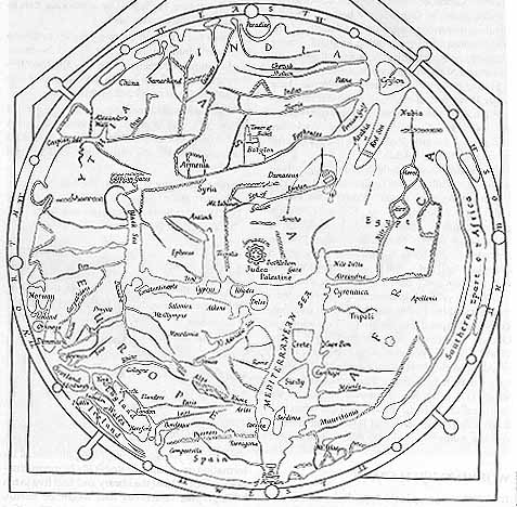
HEREFORD MAP
Found in Hereford Cathedral, England, this map is an example of the "mappaemundi" [maps of the world] that were used during the European Middle Ages. Drawn on a single sheet of vellum and measuring 54 x 64 inches, this map may have been used in a church as an altarpiece. Unfortunately, little is known of the early history of this map.
Points to Ponder:
--Maps are tools for representing geography. The mapmaker uses available knowledge to create an image. Not all maps are realistic or "true" representations of a geographic reality. For example, how "real" or "true" is a subway map?
--What city and country is at the center of the map below? Why would such a place be seen as the center?
--Can you tell which way is East, West, North and South?
--What kinds of information is missing from this map?