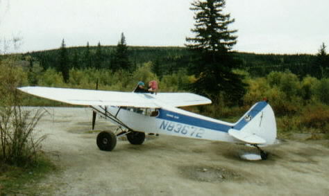 A Piper
Cub with tundra tires near Chicken
A Piper
Cub with tundra tires near Chicken
Sunday, August 31st, 1997
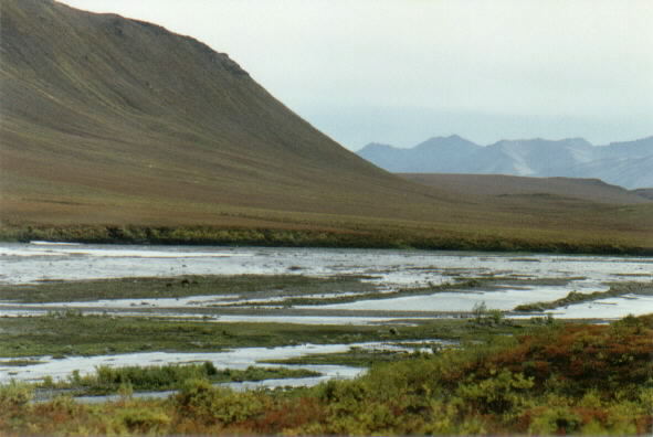 Wild horses
on an island in the Blackstone River
Wild horses
on an island in the Blackstone River
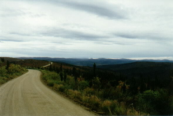
We oversleep as usual and start up the Taylor highway around 9:30am. This is a dirt road that crosses the border into the Yukon and becomes the Top of the World highway. The high rolling mountains and deep gorges are glowing red with low vegetation in this area. We stop in Chicken, Alaska, near the border, and mail some letters home from the tiny post office off of a dirt back-road. We gas up in "Beautiful Downtown Chicken" which consists of 3 false-fronted buildings serving up salmon-bake, pastries and post cards. Sean calls my attention to a solidly built woman with a very healthy moustache fueling up her old pickup truck. I know many men who would be envious of such facial hair. Nearby a man fills the wing tanks of his Piper Cub from a 5-gallon plastic fuel tank. I can't imagine where he takes off.
A Piper
Cub with tundra tires near Chicken
A few more miles of dusty dirt roads and we are at the Canadian border again. The agent is friendly and quick, and we are soon rolling again, descending towards Dawson city 106 km away. The scenery is slow to change, with one gorgeous red canyon following another. After a long descent we are back down in the trees, and after a brief period of construction we reach the Yukon River. Rainsuit-clad men wave us onto the free ferry that offers the only passage across the river into Dawson City. We are under way before I can shut off the ignition. The ferry's engines rumble noisily as it crabs the boat 200 yards across to the other muddy bank, fighting the swift brown current. The bow is shoved up onto the shore, and with a wave we are rolling down the dusty main street. This town looks exactly as I would imagine an old gold-mining town might. Many of the buildings are original structures dating back to the gold rush days.
We park and check out a few shops before deciding on burgers at a boardwalk cafe. The short-haired blond behind the counter stares at me when I ask for a soda. "You mean a pop?" She asks.
"Sure," I reply. "A pop."
"I didn't know what you were talking about. Sometimes old folks come here and ask for a soda, wanting a milk shake or something."
I order a salmon burger that isn't bad, but can't compete with Sammie's generous sandwhich. Sean and I discuss the Inuvik option. We had spoken with some tourists in a shop here in town who just returned from a 2-day bus tour up and back. They raved about the drive- saying the more southerly part is the most scenic. We talk it over as we eat, and I am pleased when we agree to head up there. We aim to make it at least as far north as where we've learned the porcupine caribou herd is migrating- above the Arctic Circle just north of the Northwest Territories border.
We make the quick drive down to the southern terminus of the Dempster Highway. We clean up, fill all the tanks and I start the long, strenuous drive at about 2:00 p.m. The gravel road starts off well with some stretches done at almost 70 mph. The truck has been handling the abuse extremely well up to this point, but I don't want to push it, particularly not on this leg of our journey, which will take us into by far the most hostile and desolate country we have yet seen. The terrain and vegetation remind us first of the low red bushes of the Denali highway area, and later of photos returned to earth recently by the Mars Rover. Huge hills of grey gravel tower over an orange river laden with sulfur. Many of the trees have turned an incredibly vibrant yellow, and the knee-high, whispy stalks of red flowers by the road's edge offer a striking contrast.
The vegetation thins as we climb higher. Deciduous trees give way to scraggly pines, some of which appear fire-damaged and show live growth only at their very tops. I can't stand battling the poor roads any longer, and I coast to a stop in the middle of a long, straight stretch along a bald ridge. We stretch and wander around the roadside for a bit, then climb back in. I've never appreciated the passenger's seat so much. The sun is setting incredibly slowly at this extreme latitude. From 8:30 until almost 11:00 it lingers near the horizon- offering countless breathtaking views.
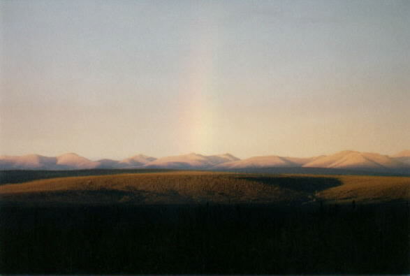 A subtle
rainbow marks far-off mountains lit by the never-ending sunset
A subtle
rainbow marks far-off mountains lit by the never-ending sunset
The gas gauge is almost on 'E' when we pull into the Eagle Plains ("Population = 8") service area- the first services available since we began this drive 370 km ago. The dingy station is a clollection of steel buildings stained a permanent gray from the road grime. We eventually track down the station attendant to pay for the gasoline. She is working on a semi in a huge repair bay off of the office. She is the only soul we ever see in Eagle Plains. After filling up we rest for a moment in a clearing next to the compound. I stand on a battered picnic table and try to frame up a shot of the expansive land that stretches out away from us to the northwest. I give up and don't take a single picture. There isn't a lens wide enough...
We cross the arctic circle at about 10:30 and pull into the rest area there for a couple of minutes. The sky still glows a healthy blue, but the billowy gray arctic clouds lay low over the hills, making it too dark for photographs. We rumble on over the loose gravel road.
Finally, we arrive at the Yukon/ Northwest Territories border, and we pull over in the light misty rain and stop the truck for the night next to the huge white steel pyramid that welcomes travelers to Canada's northernmost province. It is downright cold up here- probably getting down around freezing, but Sean still wears shorts as he has almost the entire trip. We spend an irritatingly long 1/2 hour waiting for our water to boil before enjoying healthy portions of spaghetti.
The sunset still glows a cool white under the flat clouds as we go to sleep around midnight.