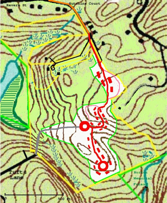
Revised plan for proposed development behind Langsford Pond.
 |
Since then, we have seen a Preliminary Plan and a Definitive Plan. (The developer is required by zoning regulations to submit such plans, but he was careful to explain that the Definitive Plan wasn't all that definitive.)
Nothing much changed, except that the big earthen dam providing the access from Tufts Lane was replaced by a bridge/dam structure with vertical concrete (40 feet high!) sides.
This proved to be the Achilles heel of the project. After a year and a half of protests by environmental organizations and neigbors had had no results, it turned out that neither the Planning Board or the engineering firm hired to review the plan believed in the engineering feasibility of this structure. And so, in January 2007, the developer has provided a revised plan without the Tufts Lane access.
The amount of the parcel to be given into conservation is now 66%, down from the promised 70%.
Detailed maps are available from the Planning Department in the City Hall annex on Pond Road.
On the map:
Orange - Hutchins Court, improved.
Red - new roads and houses.
Pink - fire roads (narrow unpaved roads to provide alternate access in case
of an emergency.)
Gray (lower left) - trench for water line to Tufts Lane.
The green lines indicate the land given into conservation (62%.) This
includes all of the north section of the parcel, which is unchanged.
The first cluster, at the end of Hutchins Court, has four two-family homes.
The other two clusters have ten single-family homes each.