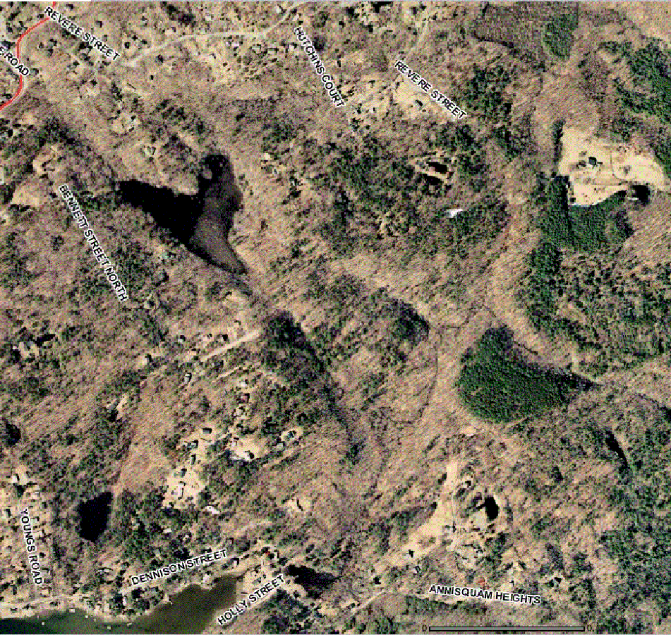
This photograph was taken in early winter (no ice on pond, no leaves
on trees) in the afternoon (low sun from lower left.) The brown color
is deceptive. The area is heavily wooded, but only the evergreen trees show.
Location.
The red line in the top left is Washington Street (Rte 127.) Revere St runs
along the top to end at the big yellow triangle in the upper right.
The "airport runway" south of the pond is Tufts Lane. You can tell the dropoff
at the eastern end by the shadows.
Bennett Street continues past the western end of Tufts Lane south to Dennison
Street. The water at the lower left is Goose Cove.
The proposed housing is in three clusters between the southern end of
Hutchins Court and the eastern end of Tufts Lane.
This photograph is 300 K and may take some time to load.
![]()