Ford Island NALF is located 6 miles northwest of the Honolulu
and about 2.5 miles west of the Honolulu International Airport. It
is currently available for landings by civilian aircraft. Very shortly
however, Ford Islands runway will be closed to the public to allow for
Navy housing. The airfield has one runway, 4/22. The chart
below is from a 1967 Local Area Chart. Notice that Ford Island has
two Airport Data Lables. The blue box in the upper right corner describes
the runways at Ford Island while the second Ford Island lable describes
the sealane. Explanations are provided below.
1967 Local Area Chart
|
ALF (Aux. Landing Field) FORD ISLAND Elevation 18
feet above mean sea level, Lighted, 4000 feet in length, VHF communications
avialable on 142.74, UHF communications available on 360.2
|
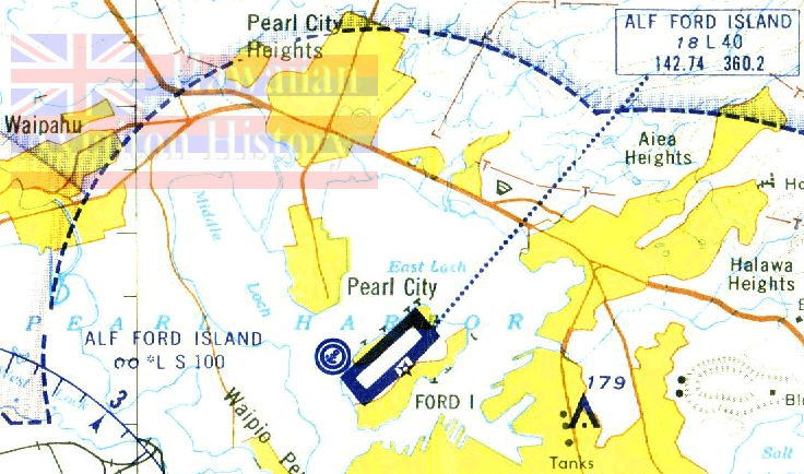
Chart Courtesy of P.B. Olsen, Honolulu, Hawaii
|
ALF Ford Island, Elevation Sea Level, Lighted but
with only with Prior Arrangement, Normal Sheltered TakeOff Area, 10,000
feet in Length.
|
Notice also the double circle with the anchor, that identifies
the sealane as being Joint Use.
Go to Ford
Island Today for pictures.
Recent History
Ford island was made available initially in 1970 for touch
and go landings under a limited use agreement. The intial agreement
ran through 1985. Over 100,000 general aviaition operations have
been accomidated in some years- quite a few for a single runway with a
length of just 4,000 feet.

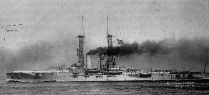
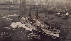
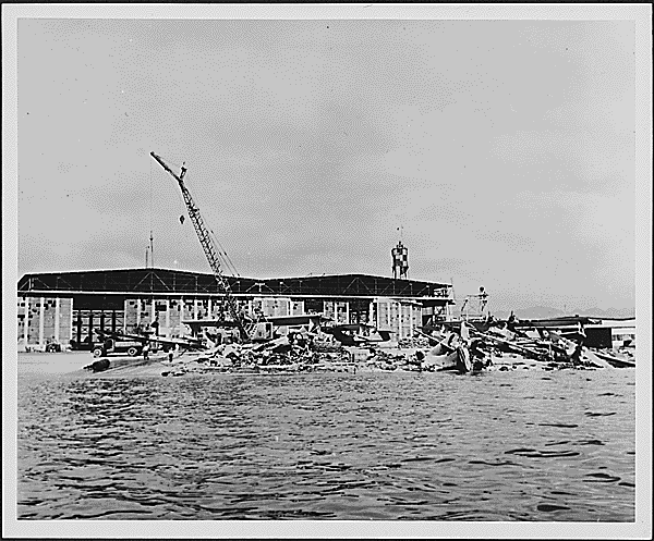
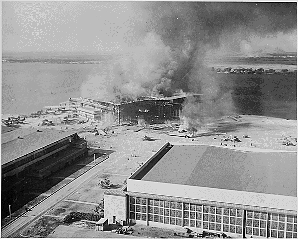
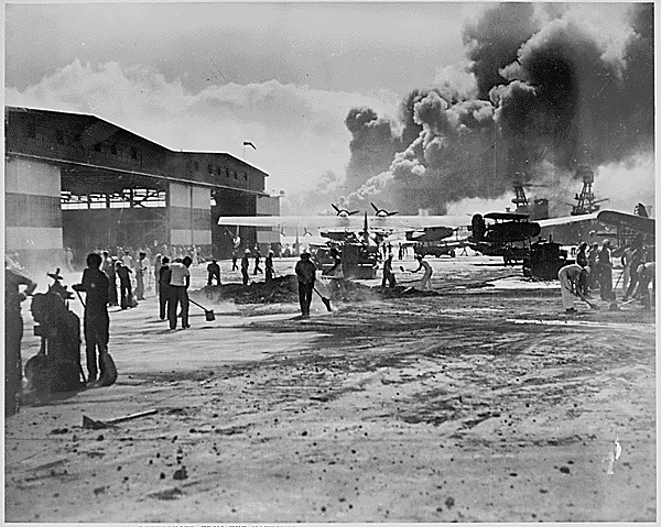
Historical Ford Island Pictures
Here is a sample of what this page will offer in the
future. Click to view these pictures.
Be sure to take a look at the links below when you are
finished
 .
.
.
.
Links to the Historical Ford Island
If you have comments or suggestions, email me at [email protected]
Disclaimer: All information contained on these pages
is true to the best of my knowledge. It has been formed from numerous
sources not all of which have been credited. Whenever possible credit
has been given for data/images. If you have information that contradicts
that contained in these pages or do not want your page linked to this one
please email me and I will correct/remove it.