Junaid's Oregon and Washington hiking diary
These are some of the hikes I have done in the Pacific NW and would recommend to others.
Most include pictures, approximate distance and elevation gain stats as well as
rating (5* being highest). Directions to most trailheads can be found in
guidebooks, such as "Pacific Northwest Hiking" by Judd and Nelson.
The 100 hikes series books also have good trail descriptions. These are all highly subjective reviews and as always YMMV.
-
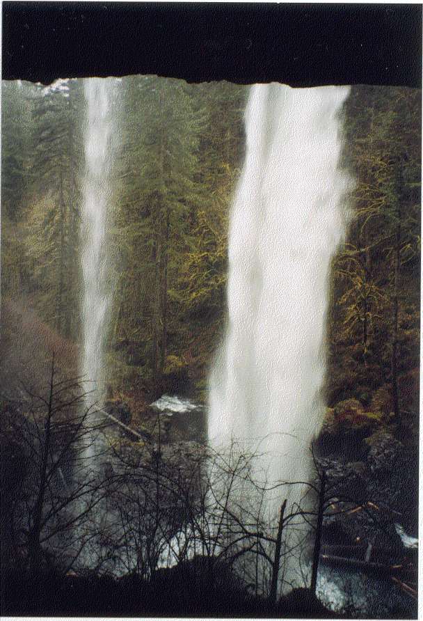
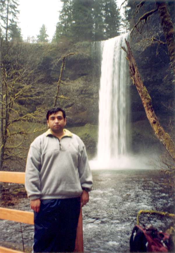
 ***** Silver Creek
Falls loop (Silver Creek Falls State park Near Salem) : Lots of
bang for your buck. It costs $3 to park but for once I think its well
worth it (its a state park not a huge federal forest). Several spectacular
waterfalls and lots of huge old-growth fir and cedar trees. Many waterfalls have
trails that go behind the fall which is really cool. Moss covers
everything. The return part of the loop along the Rim Trail is short but rather uneventful.
The back road to the park from Portland is a nice drive with hop fields
and quaint farms as well as Mt. Angel monastery which has great views of
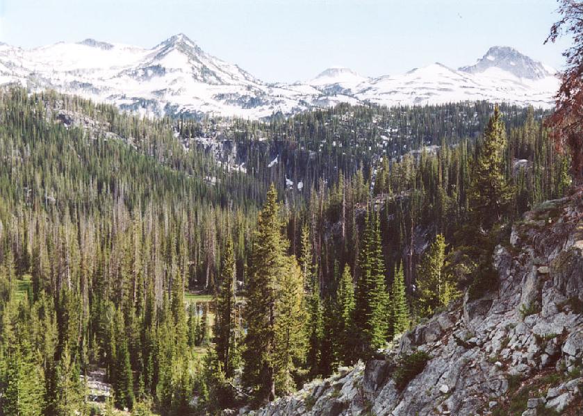
surrounding peaks on a clear day. In 2004 a section of the loop was closed because trail was damaged during ice storm in an 2004. Consequently a detour along Maple trail is required. For some reason I have done this trail twice on Dec 31st. A fitting way to end a year I guess. pic , pic, pic(10
miles, 700 ft. done 3/99, 12/31/00, 10/01, 12/31/04)
***** Silver Creek
Falls loop (Silver Creek Falls State park Near Salem) : Lots of
bang for your buck. It costs $3 to park but for once I think its well
worth it (its a state park not a huge federal forest). Several spectacular
waterfalls and lots of huge old-growth fir and cedar trees. Many waterfalls have
trails that go behind the fall which is really cool. Moss covers
everything. The return part of the loop along the Rim Trail is short but rather uneventful.
The back road to the park from Portland is a nice drive with hop fields
and quaint farms as well as Mt. Angel monastery which has great views of
surrounding peaks on a clear day. In 2004 a section of the loop was closed because trail was damaged during ice storm in an 2004. Consequently a detour along Maple trail is required. For some reason I have done this trail twice on Dec 31st. A fitting way to end a year I guess. pic , pic, pic(10
miles, 700 ft. done 3/99, 12/31/00, 10/01, 12/31/04) - **** Hurricane Ridge
(Olympic National Park) : Lots of bang for your buck. Alpine views
among lush green meadows. Trail starts from visitor center and hugs the
ridge-line with great views of snow-capped Olympic mountains on one side
and Canada across the Straits of Juan de Fuca on the other side. Lots of
wildlife including marmots and deer . Most tourist hordes fall behind
within the first mile. You can potentially take this trail 16 miles down
to the park entrance but I turned around much before then (8/7/99)
- ****
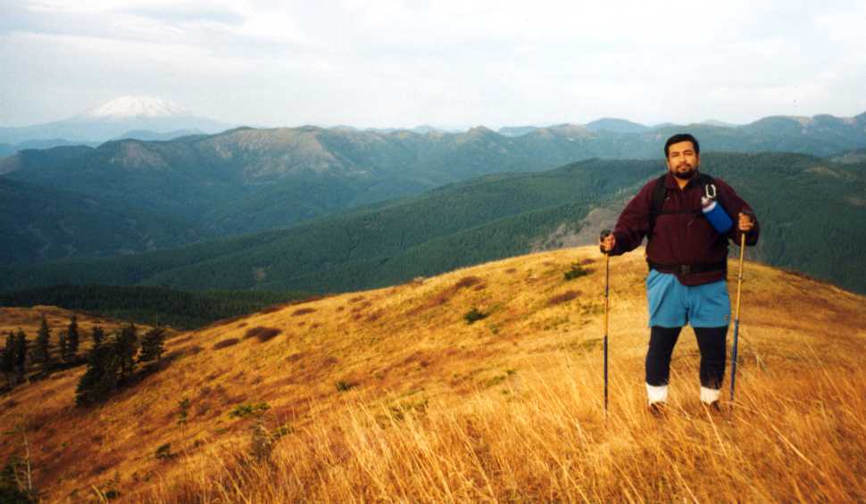
Silver Star Mountain (Near Yacolt, WA): An interesting hike
because it is on mostly on open tree-less hills where the trees were
eliminated by old forest fires. The terrain resembles some of the
hikes at the eastern edge of Columbia gorge (Lyle Orchard, Rowena
plateau, Deschutes et al) . The access is from Route 503 from
Battleground or Yacolt. Trail head is reached after a rough 6 miles of
driving up steep gravel roads. The drive instructions are as follows
: SR 503 to Moulton Falls, Right on Sunset Falls Road for about 8
miles to a county CG. Go across small bridge and get on dirt road (FR
41), follow this road for a while until you get to a sharp junction
where road 4109 is a hard right. After a couple of miles take an
unmarked road on the left which climbs up to an open ridge top and
dead ends at trail head for Ed's Trail. Trail quickly leads up an old
(now closed to traffic) 4-wheel road onto tawny grass-covered hills
and to a series of rocky outcroppings. All these rocky cliffs are
excellent vantage points to get 360 views. The nice thing about this
trail is the view it affords of all the "big boys" of the
Cascades in this neighborhood -- namely Helens, Adams, Hood and
Rainier. Even Jefferson is visible from silver star summit. They were
all covered with the fresh snow that had fallen over the last couple
of weeks. Usually you don't get to see all 4 peaks from a single
vantage point because you are actually on one of the big mountains
and the bulk of the mountain blocks off some of the view (unless you
are on the summit of course). Also the open slopes covered with vines
have the potential of affording excellent fall colors
display. Unfortunately it was too late in the year for that.
Redid this hike in October 05, a little more color but also extremely windy.
On the Silver Star trail with Mt.St. Helens in the background(5 miles round-trip, 1000 ft., done 11/6/99 and 10/21/05) - **** Trapper Creek (10 miles north of Carson, WA) I almost missed this hike because I
showed up a minute late and the hiking group had already left. However I was fortunate enough to run into another hiker that had been turned away because group had already reached the 12 person wilderness limit. We decided to carpool and do the hike anyway. If you like
Siouxon creek you will like this one. It is moderately paced and has nice
old growth and a few stream views. Creek is audible most of the time but
you get close to it only a few times. There is ample evidence of wild
life, we saw coyote, elk and deer droppings on the trail. Trail is fairly
level initially then crosses a river and heads right (don’t go left on the
soda peak trail). After a steep climb you come to another trail junction.
Go straight and then take a left at the Deer Cutoff trail for a steep
descent on a trail punctuated with roots to the creek level. Trail crosses
over the stream on a log and then ascends back to the deer cutoff trail
where you go back.(7 mi., 1000 ft, Done 4/22/01).
-
 ***** Twin Pillars (Mill Creek Wilderness near Prineville, OR): A good
Fall or Spring
hike when the mountains are shut out by snow. I decided to do one last
backpack before winter arrived in earnest. Since the John Day area was
supposed to be relatively dry I headed in that general direction. Originally I was hoping to hit Black Canyon or Strawberry Mountain Wilderness but because of a late puttering start I found myself rapidly running out of daylight. Mill Creek rapidly became the only practicable choice. The
trail started from Wildcat campground which is reached after 10 miles on
Mill Creek Rd. Hunting season had begun and there were several hunters and
horses in evidence at the campground. One guy was camped out with a huge
RV and what appeared to be a smoke house. A severed elk head adorned his
campsite. The trail started just before the campground on the side of the
stream that is away from the campground. It was nice and flat as it
paralleled Mill Creek through a very picturesque valley with pine and fir
trees. There are numerous creek crossings which have no bridges and
require some rock-hopping. A hiking couple I ran encountered told me that
hunters had warned them to make themselves scarce around dusk to avoid
getting shot. In light of this info I decided to pitch camp before it got
dark. I found a nice spot by the stream at the base of a big Ponderosa
pine. Starting a campfire was pretty easy since things were still pretty
dry. I didn't hear any major shooting that night. It sprinkled a little
bit now and then but nothing compared to the rain I had driven though to
get here.
***** Twin Pillars (Mill Creek Wilderness near Prineville, OR): A good
Fall or Spring
hike when the mountains are shut out by snow. I decided to do one last
backpack before winter arrived in earnest. Since the John Day area was
supposed to be relatively dry I headed in that general direction. Originally I was hoping to hit Black Canyon or Strawberry Mountain Wilderness but because of a late puttering start I found myself rapidly running out of daylight. Mill Creek rapidly became the only practicable choice. The
trail started from Wildcat campground which is reached after 10 miles on
Mill Creek Rd. Hunting season had begun and there were several hunters and
horses in evidence at the campground. One guy was camped out with a huge
RV and what appeared to be a smoke house. A severed elk head adorned his
campsite. The trail started just before the campground on the side of the
stream that is away from the campground. It was nice and flat as it
paralleled Mill Creek through a very picturesque valley with pine and fir
trees. There are numerous creek crossings which have no bridges and
require some rock-hopping. A hiking couple I ran encountered told me that
hunters had warned them to make themselves scarce around dusk to avoid
getting shot. In light of this info I decided to pitch camp before it got
dark. I found a nice spot by the stream at the base of a big Ponderosa
pine. Starting a campfire was pretty easy since things were still pretty
dry. I didn't hear any major shooting that night. It sprinkled a little
bit now and then but nothing compared to the rain I had driven though to
get here. - ***** Lakes Basin (Eagle Cap Wilderness near
Joseph, OR) : This was a July 4th weekend backpack.
Day1 :We traveled all day Wed (July 3rd) to get to the Wallowa Mountains. Originally I was planning to hit the trail that day but a characteristically late start dashed any hopes of that happening. Pitched camp in darkness at Boundary CG near Wallowa in a pseudo campsite. All the real sites were already taken.
Day2 : Got up early in the morning and took a short walk along Bear Creek in my new Motrail Vercors hiking boots to see if they were ready to be used for the backpack. Decided against using them since they were a little tight against my little toe and the last thing I wanted on this trip were blisters. We packed up and left for the trail-head. Our progress was somewhat slowed by the 4th of July parades in the small towns. Wallowa Lake trailhead was absolutely packed and I was beginning to get worried about finding any good campsites. We packed up and hit the trail around 1:30 pm. The trail started out along the Wallowa river and stayed parallel and above it for most of the first 3 miles. It was quite hot and dusty on the trail until it crossed a stream after about a mile and after this point water was easily available as various snow-melt streams crossed the trail at regular intervals. Lots of fly-covered horse shit and the pungent odor of horse urine was a constant reminder that horses were using this trail. The forest was mostly fir and offered a few shady patches that provided welcome relief against the heat. After about 3 miles we reached the junction of the West Fork and Ice Lake trails. We discovered a really nice campsite close to this junction with a fire ring and make-shift log benches and decided to call it a day. As I was puttering about filtering water from a nearby brook, a male deer with newly sprouted antlers appeared from the forest. It seemed remarkably unafraid and curious. We looked at each other for a couple of minutes and then my dog broke the trance by chasing it off.
Day3: We had breakfast and packed up by noon. The trail continued to Six Mile Meadow at a much gentler pace. We stopped briefly for lunch along the way and filter water. I noticed that the time being taken to filter had become inordinately large and the filter was spraying more water on my clothes than was going into the bottle. Apparently it was clogging up up but I had forgotten to bring the cleaner brush. The flies were very bothersome on this segment of the trail. They congregated in large numbers on the horse shit and would rise in clouds as we passed. They could inflict painful bites and were strongly attracted to anything remotely resembling food. We reached 6 Mile Meadow in about 3 hours. As the name implies, its a large meadow about six miles from the trailhead. Sheer granite mountains formed a dramatic backdrop to the meadow and a clear river flowed next to it. We decided that hauling heavy packs up to the Lakes Basin was above and beyond the call of duty. So we decided to camp there and do the lakes next day as a day hike. We found a nice secluded campsite in the trees close to the river and pitched camp. There were a couple of parties camped out in the meadow when we arrived and soon three more showed up. Although camping in the meadow is forbidden, this did not dissuade some of these people from plopping their tents right in the meadow close by the river. The mosquitoes had gotten progressively worse on the trail from Ice Lake junction to Six Mile Meadow and they pestered us mercilessly throughout the evening. I also tried fishing in the calmer portion of the river and caught a small trout. Later I cooked some fairly convincing rice pilaf and potato curry using the little packets of spices we had brought with us. The stove acted really weird and caught fire when I started cooking. We were afraid it was gonna blow up but it mercifully died out on its own after I cut off the fuel supply. It fired up just fine after I let it cool down and I cooked the rest of the dinner on it uneventfully.
Day4: Did the Lakes Basin as a day hike. All of the other parties packed up and left by mid-morning. We salvaged some of the neatly stacked firewood from one of the empty campsites. By the time we left for the lakes, we were the only ones left camping. The trail to the lakes was a little steeper than the previous portions of this hike and we were Glad we weren't hauling heavy packs on this part of the hike. It was hot going and it didn't help that the horses had taken perverse pleasure in shitting in all the cool, shady and breezy spots along the trail -- thereby making them a haven for the flies. The views opened up as we climber higher. It was quite impressive with sheer mountains covered with thick forest and capped with snow. The trail switchbacked up past a rushing waterfall and finally leveled off a bit near Horseshoe Lake. Horseshoe lake was probably the prettiest of the lot with a small island and expansive views. I recognized a couple of the parties camped there from their tents which had been set up in six-mile meadow last night. Evidence of horse traffic vanished from the trail as it climbed above Horseshoe Lake. We had to negotiate a tricky stream crossing by rock hopping. There was ample evidence of bygone glaciers in the shape of huge slabs of rock that had been ground to a smooth surface. We passed a couple more lakes and lily ponds before turning back at Douglas Lake. The trail appeared almost snowbound at Douglas Lake. We descended back to our camp by 7 pm and found a whole new bunch of tents had sprouted up in the middle of the meadow. A gaggle of teenagers was perched on the rocks by the river. Apparently they were part of some kind of club or social organization. I quickly tried to cook some shells and cheese in the remaining daylight but was defeated in this effort when the stove ran out of gas. Finished cooking over the campfire and then hit the sack. We decided we had had enough of the wilderness and the murderous mosquitoes and resolved to pack out the next day.
Day5: We were woken up at 5:30 am by loud thunderclaps and bright flashes of lightning. Rain soon pelted the tent. The dog was quite bothered by the noise and whined piteously. Mercifully the storm had abated by 8 when we emerged from the tent. Talked to a guy camped nearby who had just done the lakes basin and looped around from Frazier Lake. He said all the lakes above Lake Douglas were snow bound and Glacier Lake was frozen. Quickly boiled some water on the campfire to make some cup'o noodle and then packed up and hit the trail. The six miles out went considerably faster that the hike in. We would have made it out in about 4 hours except that the dog started acting really weird near the end of the hike when we were within a quarter of a mile from the trailhead. He seemed to be suffering from heat exhaustion and repeated tossed his pack off. On closer observation I found that his pack was literally soaked with sweat. So I carried the dogs pack and we gave him the last of our water. We managed to stumble along and were out by 3:30. Then we quickly cleaned up a little at the restroom near the trailhead, changed into clean clothes and drove 350 miles back to Portland. On the way back we stopped at a KFC in Baker City and gorged ourselves on the buffet. Ah the decadent delights of civilization! All in all it was a very memorable trip. Although many hiking books suggest this trail is very crowded, we did not encounter more than 3-4 parties on the trail each day. Its the longest backpack I have done to date and I learnt a few new tips (pack extra fuel and water filter cleaning brush). The only parts of it I would like to forget were the pesky mosquitoes and flies. (20 miles, 2800 ft, done 7/4-7/2002)
View of the sheer mountains
On the trail
View from the trail
View of mountains across the valley on the trail to Lakes Basin
Horseshoe Lake
nice view of snow capped mountains from Lakes basin
Six Mile Meadow - ***** Old Snowy (Goat Rocks Wilderness, WA) : A nice hike but shadowed by bad luck all the way. Got an unfair speeding ticket along the way to trailhead. The trailhead was at the end to a 20 mile dirt road and was packed with cars. Saw some bow hunters leave about the same time as I did so I guess hunting season has started. The 2 miles to Goat Creek went pretty fast as the trail angled more or less down at a gentle grade. The creek had a very sturdy bridge with big log railings. Here I met the hunters again, chit-chatted for a awhile and discovered they were out looking for elk. After the creek the trail started to ascend at a moderate angle. I was hoping to reach Boundary Camp but the rapidly declining daylight forced me to stop earlier. I discovered a hidden side trail that led to a delightful campsite by a stream and pitched camp. The only thing that made me check out this place was a small pink marker ribbon tied to a log. There was a fire ring and a nice bench fashioned out of a fallen log and even a marshmallow toasting stick was sitting propped against the bench. I availed myself of these amenities and pretty soon had a nice fire going and finished almost an entire bag of marshmallows by myself. Hit the sack around 9:30 pm.
Up early to discover fog and clouds. The fog was rolling in and seemed in no mood to lift anytime soon. I packed up after cooking breakfast and bid farewell to my campsite. Saw a couple of hunters come up the side trail as I was about to leave. Apparently they were the ones who had marked this place since the pink ribbon was gone when I left. The trail kept going up and the weather kept getting fouler. I soon passed a trail junction (bypass trail which angles up to meet PCT toward Cispus Basin). I kept following the Snowgrass trail and soon came to a meadow with another trail junction with the Lily Basin trail. This place was occupied by several camping partied and I was glad I had camped below since this place seemed totally full. The weather had become steadily nastier as I ascended and the wind was becoming quite strong. The trail switchbacked up a few times and then entered Snowgrass Flat. There were numerous campsites in the trees right next to the trail and I picked one of the vacant ones and dumped my pack to claim my occupancy. It was about this point that I discovered I had lost my wristwatch somewhere along the trail. This distressed me considerably since I rely on it heavily to figure out time I have been hiking and ETA of return to trailhead. I had taken off the pack a little ways down to don gloves, wind-shell and hat. I suspected that my watch might have fallen off when I put my pack on. This has happened a few times before when I backpacked but I usually detected it immediately. I went down quite a ways in pretty shitty weather but saw no signs of the watch. Came back and went up to the PCT junction which was just a few hundred yards from where I had decided to setup camp. It was much more exposed and wretched above the junction so I decided to stick with my original campsite choice. Set up camp and crawled in just as rain started coming down in earnest. The wind also whipped up and I huddled in my tent and wished I hadn't come on this trip. Cooked up some chicken/rice stuff in the tent vestibule area and whiled away the time the best I could. Being in the tent without a watch made the time seem to pass interminably slowly. I managed to set the clock on my digital camera and used it occasionally to monitor time. Around 6 pm the wind died down and rain stopped. I emerged from the tent and decided to take advantage of the weather to mount yet another search for the watch. This time I went all the way down to Boundary Camp and even poked through the bushes on the side of the trail but to no avail. There were a few glimpses of Old Snowy, Ives Peak etc in the evening as the clouds lifted. At night I looked out the tent to see starry skies. Finally went to sleep after resolving to pack out immediately if weather did not improve the next morning.
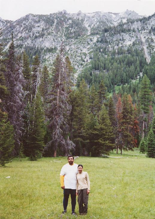
Woke next morning to clear skies and bright sunshine. Came out of the tent and was stunned by the view of Adams, it looked HUGE with a lenticular cloud hanging on its summit. Quickly cooked some more chicken and Lipton Rice. Fed the dog and hit the trail to Old Snowy by 10 am. The views back to Adams, Helens and surrounding ridges were very impressive and the remaining vestiges of summer flowers added a lot of color to the meadows. Marmots sat on boulders and called out to each other in piercing whistles that drove my dog nuts. I headed left toward Old Snowy on the PCT. The trail climbed up gently past a dilapidated stone shelter and crossed a large snowfield to reach a saddle where the PCT headed across a glacier. There were great views of Goat Lake as well but no sign of Rainier. Apparently it was still shrouded in clouds. The clouds also began to thicken and the wind picked up as I reached the saddle. The summit of Adams was also quickly obscured by clouds. The trail up to Old Snowy summit headed right at the junction. I lost the trail in a maze of confusing cairn and had to do some boulder hopping before I rediscovered the trail. The dog did a good job of route finding after some initial trouble. I stopped to put on my wind shell and hat and discovered a hard object wrapped in my wool cap. Much to my surprise and delight, it was the wristwatch. Suddenly I felt a lot better about everything. The trail was quite clear after this point except for a small scramble up some rocks in the final stretch. I made it to the summit fairly quickly from the saddle. The weather was quite foul near the end and the wind was kicking up so hard that it would blow my hiking poles askew before I could place them. A couple of guys from Portland who had camped in Cispus Basin were also trying to do this hike and we managed to reach the summit about the same time. After some desultory conversation, I headed down after taking the obligatory photos and snacking on a granola bar. It had taken me about 2.5 hours to climb Old Snowy and I was back at the camp by 1:30 pm. After quickly breaking camp, I headed down and was out at the trailhead by 5 pm. Here I was distressed to find a $30 fine awaiting me in the windshield. In all the years of hiking this was the first time the USFS pigs had actually left a fine. Needless to say it just put the icing on my run of bad luck. I thought Clinton et al were ruining the National Forests but Bush the imbecile has made them pale by comparison. I guess the days of free access to public land are over. (Done 8/31-9/01, 2002, 14 miles, 3300 ft)
Redid this Aug 29-30 2004. This time I camped at Boundary Camp below Snowgrass. We went to Goat Lake the first day and to Goat Crest the 2nd day. Climbed Old Snowy on way back from crest. The weather was much nicer. Topo Map of Goat Rocks - *** Junction/Clear Lake Loop (Indian Heaven Wilderness, WA) : This was a group hike arranged by ONC. Dogs were allowed on this hike but I left mine at home to improve my chances of carpooling. The drive to trailhead was pretty long. The road turns to washboarded gravel 2 miles before Goose Lake. The trail was absolutely packed with huckleberry bushes and all the hikers couldn't resisit the lure of occasionally picking a handful as we hiked along. The first couple of miles to Junction Lake were fairly flat and unremarkable. A few small meadows and couple of ponds are the only thing that break the monotony of the trail. Junction lake was a pretty longish lake with some nice camp sites. The loop started at the far end of Junction Lake. We did it in the counterclockwise direction. A short moderately steep section led to some more level walking among nice meadows with vegetation that was turning all shades of red and yellow. Soon we reached Lemei Lake and decided to break for lunch. I took some time after lunch to pick some huckleberries and fill my lunch box. The trail continued to meander among meadows and past lakes of varying sizes (Clear Lake, Elk Lake) before returning to Junction Lake. Elk and Junction Lakes are probably the more sizable lakes. From here it was a quick and straight shot down to trailhead. Nice hike and all the more enjoyable in huckleberry season. (10 miles, 900 ft, Done 9/15/2002).
- ** Opal Creek (Between Salem and Detroit): This was an offering on the 2003 spring hiking schedule of the Trails Club. I had heard a lot about this one since it was a major environemntal fight in the 80s. Unfortunately the weather was miserable during the hike and it rained heavily and incessantly throughout. The hike started at a closed gate. There are people who live in Jawbone Flats (a small mining encampment) and their vehicles still travel the road. The creek was visible for most of the walk, and the drudgery of the road was mitigated by some nice side stream waterfalls and a dank-looking mine shaft. After a while the trail reached the remains of old mining equipment and the first major waterfall on Opal Creek. From there we crossed a bridge and started hiking on the trail proper. The trail went through some pretty stately Douglas Fir and Cedar forest. It also climbed up and down a little but but there was no major elevation gain or loss. There are a couple of nice campsites along the creek that might be nice for a weekend backpack. After a while we reached a lunch spot but the rain dampened everybody's spirits. It was raining so hard that I could only manage to eat half my sandwich before it dissolved into a soggy mess. Soon after lunch we came to a nicespectacular slot canyon with a waterfall plunging into Opal Pool. This is the 3.4 mile mark on the hike. Here the group revolted against going to the Cedar Grove and instead took the bridge and road loop back to trail head. I have to say that this hike could have been very pretty but the weather and the long road portion of the hike made it a pretty mediocre experience for me.(7 miles, 300 ft, Done 5/4/2003).
- ***** Silver Star from Washougal side ): A great fall hike. Mark and I drove up to the trailhead bright and early on a crisp and clear Saturday in October. The trailhead is located at Grouse Vista. Take Washougal River Road, left at Bear Prairie or Skye Rd. Another Left (Rt if coming from Skye) on Skamania Mines Rd. Follow road 6 miles past a cottage that looks like its out of a fairy tale (Ritchie's). I was expecting a rehash of the Silver Star hike I had done 3 years ago but this was a much steeper trail on an old 4WD road. The initial portion was in dense but scraggly forest which made one feel like being ina tunnel. The trail broke out in the open after a fairly steep and gruelling climb. Here the entire hillside was a blazing expanse of oranges, yellows and reds from the the huckleberry and vine maples. The trail continues at a more humane pace along this hillside with expansive views of the surrounding hills but no sign of the big boys. It renetered an overgrown old 4WD road and finally broke out in the open near the summit. The views from the summit were stunning. The Gorge, Rainier, Adams, Hood and Helens were all arrayed before us from this airy perch. Even Jefferson and the Sisters could be made out as well as the Coast Range. After admiring this view for almost an hour, we returned the way we had come. On the way back we took a little loop return on the lower open section of the trail. The return side had some good view of Mt. Hood which we had missed when going up. There were some redneckish folk horsing around on ATVS near the trailhead and their engines could be heard for much of the lower part of the trail. The occasional pop of a gun was a reminder that hunting season had begun in earnest. This was my first hike after Diamir's death and since starting my new job. Its amazing how much attachment I had developed to him and how much I missed him on this hike. Ramadan starts either tomorrow or on Monday and that means no more hiking for the next month.
Redid in march 05 with Lasso. Lots of snow on the final 1/2 mile of trail.
Redid in oct 05 in miserable white-out conditions. Ran into only 2 people, one of whom was the TV political analyst Tim Hibbits. (8 miles, 2400 ft, Done 10/23/2003, 3/6/05 and 10/16/05).
f
- ***** Sliding Sands (Haleakala National Park, Maui, HI): We fetched up at the visitor center after a pretty drive that went through several climate zones in only 40 miles. The view into the crater was awesome with numerous red and black lava domes littering the base of the crater and clouds loitering at the mouths of Kaupo and Ko'olau gaps. The trail is labeled sliding sands but it was actuallly pretty stable footing. Nothing like hiking up the ashy slopes of a Cascade volcano. We encountered a couple of horse parties which were kicking up liberal amounts of dust. Lots of horse shit along the trail as well. Stark and beautiful landscape with garishly colored cliffs forming the wall of the crater and similarly colored cinder cones littering the floor of the crater. The clouds would come into the crater periodically and then retreat. We quickly lost 2000 ft and fetched up at the bottom of the crater where the trail meandered among the cinder cones. We cames across a lot of fairly tame Chikors (pheasant?) that were introduced here from the subcontinent and are thriving. There were a few pockets of silversword ferns and other weird looking plants growing in the desolate moonscape of the crater, making the whole place look like the surface of an alien planet. We had lucnh on top of a small hillock and then continued as trail kept losing elevation at a gradual pace. There wasn't a specific turnaround point so we just turned back after the sun disappeared behind the crater rim. The climb out was considerably harder as our lungs labored in the thin air. Having driven up from sea-level to 10000 ft in a couple of hours meant we were totally unacclamatized. The clouds invaded the crater in a decisive push as soon as the sun vacated the "house of the sun" aka Haleakala. The display of colors on these clouds was quite pretty and made us regret missing the "sunrise on Haleakala" experience that most tourist guides recommend. We were overtaken by the clouds eventually and surrounded in cold wet fog as we climbed up the last few long switchbacks and reached the summit. (7 miles, 2000 ft elevation gain, Done 12/23/04)
- ** Clackamas River/Pup Creek Falls (Off Hwy 224, 17 miles from Estacada, OR): Did this hike with the Mazamas. Originally it was supposed to be a shuttle hike but the leader changed his mind since with only 2 cars it would have required a long wait at the trailhead while the other car was dropped off. There was some black ice on road and it was quite cold and frosty under clear skies. The trail parallelled the river, climbing and losing 200-300 ft several times in lovely forest setting. Along the way we saw 4 small side waterfalls. Initial portion of trail showed some evidence of a recent fire but apparently it did little damage. There was only one thing marring the prettiness of this hike -- cars zipping along 224 on the other side of the river. After about 3 miles we came to a side trail leading up to Pup Creek falls. Jaded as I was from the Silver Falls hike done only two days ago, I was still very impressed by this 180 ft fall that has 3 tiers. The upper one is solid but the lower 2 are fan shaped and lacy making for good slow shutter shots. We had lunch near the falls and then returned the way we came. (7 miles, 1300 ft elevation gain, Done 1/2/05)
-
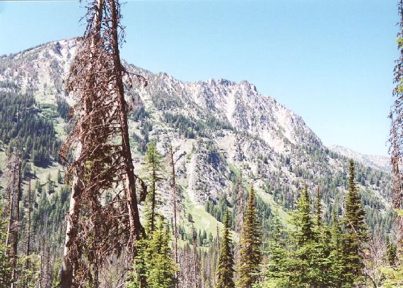
 ***** Mt. Stone (Olympic National Park) : This was a Mazama Climb. We carpooled up on Saturday to spend the night at a cabin near Lake Cushman owned by a couple who was part of the climb group. On Sun morning I got up around 3:45am and we left for the trail-head at 5 am. The TH for the Putvin trail is along the Hamma Hamma Rd. and we reached it at 6am. This trail was quite an eye-opener for me in terms of its level of difficulty. It started out along the White Horse creek and quickly started ratcheting up the steepness. The first couple of miles were like interval training on a treadmill. It would ramp up steeply then level out for a bit then another steep ramp. We got some good views of Mt. Pershing through openings in the trees. This initial section climbed a 1000 ft until we reached an abandoned forest road and entered a thick forest in the Mt. Skokomish Wilderness. The trail really started showing its true colors in this section. It headed unrelentingly uphill at a very steep angle with lots of roots and steps punctuating it. The dark and gloomy forest made it feel like going up a tunnel. It reminded me a lot of the steep section on Mt. Defiance -- same angle and same lack of switchbacks. The trail climbed close to 1500 ft before breaking out into the open at a flat bench at about 4000 ft level. The views were pretty nice here with a waterfall on the left side and lots of flowers. Small white pearly everlasting, yarrow, penstemmons, tiger lilies etc. Once could also see some low peaks surrounding this flat bench. The flat section was all too brief and then the trail charged up the headwall in the steepest section yet. It included some 3rd class scrambling up a couple of rocky sections. I can only imagine how hard it must be with a 40+ lb pack strapped on. After we climbed up the headwall the trail flattened out. We crossed a stream where I filtered some water having polished off 2 litres of Gatorade on the climb. We then entered flower-filled meadows in what I would call the pay-off section of this hike. The meadows were a joy to behold after the grueling climb. Expansive views to Mt. Skokomish and Mt. Stone. St. Peters Gap was a clearly visible notch on the right side of Mt. Stone. There were some pretty muddy patches along this stretch of trail. We soon reached a small pond and the national park boundary. The climbers guide book suggests going up a climbers trail toward Peter Gap from the park boundary but we couldn't spot any trails despite scouting around and scanning the slopes near St. Peters Gate with a binocular. After this we climbed yet another steep section. However this section didn't feel quite so bad because of a wild profusion of flowers. It was really one of best wild-flower displays I had seen in quite a while. We soon topped out at the Lake of Angels. Originally our climb leader had ruled out any possibility of visiting the lake so I was kind of glad we had missed the climber trail. The teardrop-shaped lake was set in a spectacular steep-walled basin under Mt. Skokomish. I quickly snapped a few photos while the leader scouted out a route toward St. Peters Gate. We ended up heading cross-country along flower-strewn slopes. Everything from blooming heather to dense patches of paintbrush flowers made this a very pretty walk. It was a little tricky to find good footing on the steep slope. We then entered a big section of lava boulders and were ordered to dig out our helmets and put them on. The boulders were fairly stable and consolidated so it wasn't too difficult to cross them. We took our time negotiating the boulders and eventually reached the slopes beneath the gate. There was faint climbers trail here and it angled up along the base of Mt. Stone to the left. The going here was pretty dicey with loose scree slopes. My left leg started to cramp up with all the slipping and sliding. The traverse seemed to go on forever and I started to lag behind. We had been hiking non-stop across rough terrain for nearly two hours since the Lake of Angels and I was beginning to tire. However the leader was in no mood to stop. Understandable given the rock-fall danger. Finally I reached a point where I just didn't want to continue with this slog and told Paul (the climb leader) that I was done for the day. He wasn't too happy with it but told me to go down to some snow patch well away from a rocky chute below which we were standing. I suggested an alternate site with a big rock overhang and he reluctantly allowed me to stay there. The group vanished around the corner and I took off my pack and prepared to eat lunch and chill for a while. However I had hardly dug out my sandwich when Jim shouted that they had found me a nicer spot with good views if I wanted to come over there. I walked over to this point which was like 5 minutes away and was blown away by the expansive views into the heart of the Olympics. I could see Mt. Olympus and Mt. Anderson as well all the surrounding ridges with dozens of impressive peaks and spires soaring into the clear blue skies. It was a truly uplifting sight to behold and I felt pretty energized after looking at it. Turns out that this was the base of the climbing route up Stone. I looked at it and it didn't look bad at all. It was firm rock, not the loose chossy shit we had been traversing on for the last hour. I asked Paul if I could dump my pack and join them, he was a bit reluctant at first but relented after asking me to put on my harness. I quickly dug it out and put it on, however Andrew the climb assistant double-checked it and found I had messed up the leg loops so I had to straighten that out. Then we scrambled up some fairly steep rock slopes using abundant hand and footholds. After a 150 ft or so of scrambling we came to saddle with a small snow field. We crossed it rapidly to reach the base of the summit pinnacle. Here the route became unclear and Paul led us through a narrow cleft on the left side to a very exposed ledge several hundred feet above a snowfield. Here he went up a fairly steep crack to scout out the terrain and set up a hand-line. Everybody was ordered to put on their harnesses. I was feeling pretty scared at this point and wondering what the hell I had let myself in for. Paul soon called us from above and told us to backtrack since he had found the main climb route and it was behind us. So we scrambled back through the narrow cleft and found Paul standing above a very steep 20-30 ft section. Apparently this was the climb route because it had a big cairn at the base of it. We had missed it because the cairn was built right at the base of the pinnacle and melded into the background. I was the first to go up it. I focused on not looking down and just concentrated on finding hand and footholds one step at a time. Before I knew it I was standing next to Paul. He told me follow the straightforward slope to the summit and sign-in at the summit register. I followed the directions and soon emerged onto the summit. The 360 degree view was absolutely amazing. The whole Bailey range as well as the interior of the Olympics spread in one direction. Skokomish, Pershing, Elinore, Washington, Bretherton, the Brothers, Cruiser and countless others. In the distance the sprawl of Puget Sound, Downtown Seattle, Hood Canal. And Beyond that the entire Washington Cascades from St. Helens, Adams, Rainier, Gl. Peak, Shuksan and all the way to Mt. Baker. This was the first time I had seen all of them in one shot and I was amazed that it could all be seen from a single vantage point. Looking down we could see turquoise Lena lakes. The whole team (all five of us) were soon up on the summit. Lots of hand shakes and summit shots ensued. We all signed the summit register and admired the views. It had taken us about 7.5 hours from TH to summit. It was about 1:35 pm. We stuck around on the summit for a good half hour before starting down. I was secretly dreading this part but figured with the rope and hand-line it would be OK. The last section didn't seem as scary as I thought it would and we all managed to down-climb it unassisted. We quickly made our way back the saddle to the initial scramble. Here Paul and Andrew spent some time discussing whether to put in a hand-line. It seemed like a waste of time to me since we had done much tougher shit on the summit pinnacle and I said so. Paul decided against the hand-line once I piped up. We quickly descended this section and were soon back to the point where I had ditched my pack. We stopped here for lunch and then put on gaiters and headed down the scree. It was not as difficult as I thought and in some places it was downright easy to plunge step in the loose stuff. We quickly descended to the notch and then decided to make a bee-line for the pond that was clearly visible below us. This involved making our way down to a relatively light-colored boulder field below Peter Gate and then following it down to a small creek. We followed the small creek, bushwhacking our way through alder thickets and liberally using vegetation belays. Unfortunately this led us to a sheer drop-off right above a pond. We started heading left toward lake of angels side. A lot of cursing, thrashing around and bushwhacking led us to a sizable stream running in a small canyon. There was a somewhat faint trail running along its true-left bank. We followed this and it eventually led us right to the Park boundary sign. I applied some more tape to my feet near the "pond of the false prophet". From there we had to a long, long descent back to trail-head. I stopped along the way to filter some more water. I consumed a staggering 6.5 litres of water on this climb. The trail was pretty steep and we all slipped and fell in the muddy section. Paul and I fell almost simultaneously in one particularly treacherous section. We had to scramble carefully down the dicey class3 sections of the trail along the headwall before entering the gloomy forest section. The bugs had been pretty mild on the way up but they were out in force now and I suffered quite a few bites before liberally dousing myself with DEET. The rest of the trip down was uneventful but seemed to take forever. The steepness of the trail precluded a speedy descent. For once my altimeter was accurate and I hit all the key way-points at the exact elevation readings it had shown on the way up. By the time we got down, my feet and toes felt like someone had run them through a meat grinder. I hobbled out to the TH at 8pm after spending 14 hours hiking. We all breathed a collective sigh of relief and broke out the cold beverages and Pringles chips. Then back to the Lake Cushman cabin to drop off Jim and Laura and the 3 hr drive back to Portland. Quite a memorable trip all in all -- my first real hike in the Olympics. I have to say I was very impressed with the flowers and views but somewhat disappointed at not seeing a single mountain goat. This area has countless exploration possibilities but the steep trails and limited camping permits are a real obstacle to backpacking. (7/31/2005 10 miles , 5100 ft elev gain)
- ***** Cispus Basin (Goat Rocks) : This was a backpack I did with Ben, a guy I met on Craigslist. We carpooled up on Saturday to the Berrypatch/Snowgrass trail-head and hit the trail by about 2 pm. The trail was much as I remembered it from before. Gently up and down to Goat Creek then the switchbacks up to the trail junction with Bypass trail. This time we took the Bypass trail. It crossed a couple of streams and kept climbing through forest and meadow to the junction with PCT. The lupine was mostly gone but a few asters and paintbrushes were still blooming. The PCT was almost flat with very little elevation gain or loss. We quickly started getting good views of Goat Rocks and Adams. The trail rounded a bend and we finally got a view of Cispus Basin. Its an awesome amphitheater ringed with rugged cliffs. The sheer cliffs of Big and Little Horns dominate the view at the head of the basin. Dozens of streams come down from the sides of the basin and combine to form Cispus River. The trail hugged the sides of the basin and exited it at Cispus Pass after running around the edge of the basin. I was so taken with the view that in a couple of places I lost my footing on the narrow trail and slid off downhill. After passing a nice waterfall we came to the biggest stream on the trail and found a nice campsite in a clump of trees above the trail. It was about 5:30 pm so it had taken us 3.5 hours to go about 6.5 miles. We quickly set up our tents. I chose a dusty flat spot among the trees. This was the first trip I was using the MSR stove I had bought at the Mazama used gear sale. I had to read the directions I had downloaded off the internet. It worked OK and I cooked up some Lipton rice and tuna. The temperature dropped quickly as the sun set. There had been some clouds building up through out the afternoon but they quickly dissipated in the evening. I took a quick jaunt up to Cispus pass with the dog as my dinner cooled. After dinner I got into bed quickly as it was getting quite chilly. The sky was clear and I kept my tent door open hoping to see some leftover meteors from the Perseid shower that had happened on Fri. However I only saw one measly meteor. Soon I drifted off to sleep but it was fitful as usual. The dog whined periodically. He was not happy at being tied up but both dogs had been finding human shit and eating it so I had decided to tie him up for the night. Apparently people who camped here before hadn't heard of digging a cat hole and were taking dumps in the open and putting a rock on it.
Up at 7 am. It was pretty cold so I put on all layers I had and steeled myself to get out. After the usual morning chores I took another walk up to Cispus Pass to get some good shots in the early morning light. The basin stayed in the shadow for a long time before the sun broke over the Big Horn and warmed things up. We set off for the saddle below Big horn (right side) around 11 am to with a view to climbing Gilbert peak. There were gigantic scree slopes at the head of the basin so I left the dog tied up at camp because I knew they would rip his paws. Lasso put up quite a protest and I did my best to ignore his whines as he saw us wandering farther and farther away. There was no trail but plenty of goat tracks. The place was carpeted with lupine plants, just seed pods left on most of them. In season this place would no doubt have one of the best flower displays in the Cascades. We soon got above the meadow onto scree. Periodically we would see large circular patches in the dust where goats had apparently been rolling around taking dust baths. It took us about an hour to get to the saddle and we were rewarded with a great view of Adams. The saddle overlooked a second basin below and some really steep looking stuff to the left. We searched in vain for the "broad obvious gully" described in the climbing guide but couldn't;t see any. After a while we decided to contour along a faint "trail" that skirted the base of the cliffs toward a small stream. This trail or goat track was pretty faint but it led to a cairn at the base of a fairly steep and crumbly gully. While traversing this I finally spotted my first mountain goats. There were two of them kicking up big clouds of dust on the slopes above the 2nd basin. This gully was the only possible path that I could spot so I called Ben back, he had continued contouring past this point. We went up the gully a little ways but it seemed quite dangerous and steep to me. The footing was quite sketchy and looking down was somewhat unnerving. It also seemed too close to saddle and we were beginning to question whether we were going up the gully leading to Gilbert or if it was leading elsewhere , maybe a scramble to the base of the Horns. Anyway I decided to call it off after going up a little ways. Coming down the gully was not pleasant and I had to sit on my butt and slowly lower myself in places. We made short work of the way down and were back in camp within 30 minutes. It was about 1:30 pm. We had earlier agreed to leave by 3 pm. Since I had some time to kill. I decided to head up to the saddle on the left side of the horns. I untied the dog and we followed a ridge up to the orange colored cliffs below the saddle. The views from the saddle were spectacular, the glaciated side of various Goat Rock peaks like Old Snowy, Ives etc, were visible as well Rainier and Adams looming in opposite directions. I spent some time at the saddle admiring the view before retracing my steps back to camp. We packed up and left by 4 and were back at the TH by 7:10 pm. This is one of those trails that takes just as long going back as coming in. Of course the going was slower because I was feeling really beat and also munching on the occasional huckleberry that caught my attention. (16 miles, 3000 ft, 8/13-8/14/2005 - ** Moulton Falls : This is more of a road walk good for a quick hiking fix during winter. The falls are tucked away on Lewis River near Battle Ground. There is well-used trail that from parking lot that crossed over a scenic bridge and led to an old dirt road. The road leads back toward Lucia Falls, passing a pond and some small side stream along the way. There is also a trail marker which suggests its possible to get to Silver Star from here if you want to do a 21 mile hike. (6 miles, 50 ft)
- Wenaha River This backpack was arranged by the Trails Club. We drove Friday evening to La Grande and camped overnight at a campground outside the city. Next morning after gorging ourselves on pancakes we drove to Troy via Elgin. There was a couple from Seattle (Jack and Diane like the John Cougar Meelencamp song) who were waiting for us at the trail-head and we quickly made final prep and slathered ourselves with sunscreen before hitting the trail around 1230 hrs. This turned out to be a big mistake since it was hot as hell. It was about 100 in the sun and 95 in the shade. The trail hugged the canyon wall above the Wenaha River with no shade and the canyon walls amplified the heat. The scenery was pretty with stark rock formations lining the V-shaped canyon's rim. Wenaha River was clear, running wide and shallow in most places. After about an hour on the trail we were all sweating profusely and flirting with heat exhaustion. The trail came down to the river and we ditched our packs in a shady spot and spent half an hour lounging around in the shade and splashing in the cool river water. The original plan was to travel 9 miles to Fairview Bar to set up a base camp and then do a few day hikes, but it rapidly dawned on us that this was an overly ambitious plan given the scorching heat. The mid-day sun hit you like a hammer as soon as you stepped out of the shade and there was virtually no escape from it on the trail as it ran along the canyon wall. After resting up we manged to struggle along for another 1/2 hour before collapsing at yet another shady spot along the river. This time we decided to stay put until the afternoon heat wore off, or even just camp at this spot. I dug out out my sandals and spent considerable time wading in the river and splashing around to cool down. It was quite pleasant in the shade once I cooled myself. A light breeze and virtual absence of bugs made it a delightful resting spot. I saw what appeared to be a garter snake swim in the water and then slither away on the rocks. This area is notorious for rattlesnakes and we had run into a party that mentioned seeing 7 rattlesnakes in one day. Around 3:30 pm I noticed thunderclouds building up. Soon one of them drifted across the sun and I suggested we take advantage of this shade to gain some more distance. Accordingly we packed up and hit the trail again. The sun soon burnt its way through the clouds and we had no option but to keep marching on in the blazing heat. Another problem was that whenever the trail came down to the river it passed through dense overgrown and thorny shrubs that virtually obscured the trail and made it a painful bushwhack. We kept this up until reaching the junction with Crooked Creek and the Panjab trail. It was about 6:30 pm and we all decided this was as far as we could push ourselves. We found a nice spot with a fire-ring and improvised benches and quickly picked 3 tent spots. After doing the usual chores of water filtering and filling up the water bag I tried to make dinner but almost started a grass fire. As soon as I lit the stove, flames engulfed the stove and bottle. Apparently there was a leak between the fuel bottle and the fuel line coupling. This caused me much consternation but one of the other parties had an older MSR stove so we agreed to use that stove and pool the fuel. I was pretty tired from the hot hiking and hit the sack early.
Next morning we were all up by 7am and ready to hit the trail by 9am. It was another infernally hot day. Our plan was to day hike to Fairview bar and then follow the Weller Butte trail for a while to get a panoramic view of the canyon. The trail was even brushier than yesterday and stayed low. We saw nobody on the trail except three fisher dudes who walked through our camp in the morning while we were getting ready to leave and then a guy with 3 kids in tow on the trail. We took hourly breaks by the river to cool down and filter water. We made faster progress than expected and were at Fairview Bar in 1.5 hours of hiking. After resting up and snacking a little, 4 of us decided to go up the Weller Butte trail. The heat was brutal initially but became tolerable as we climbed a couple of hundred feet. Ponderosa pine trees afforded some shade and a light wind helped as well. The views of the canyon were magnificent from our higher vantage point. The remarkable drop in temps seemed to indicate that the canyon was indeed reflecting the heat at the bottom which was intensifying and magnifying the hot temps near the river. We returned to our base camp after this hike, taking a couple of breaks along the way. I was so hot that I dug out my sandals and basically lay in the river and just let it wash over me and cool me down. This resulted in a refreshing drop in my core temp and I was able to hike for half an hour after this without breaking out in sweat. Back at the camp I was able to get my stove going after messing around with an O-ring I found in the repair kit. This delighted me immensely and I immediately made some Ramen noodles for dinner. In the evening (8:30 pm) I took a small walk to the nearby bridge over Crooked creek. On the way back I almost stepped on a rattlesnake that was coiled up next to a rock in the middle of the trail. There were a couple of bird feathers lying next to it which might have been the remains of its last meal. I called excitedly to the others to come take a look and then turned back to walk up the trail to make sure it was still there. Well it was a lot closer than I thought, and I almost stepped on it again. It rattled furiously making me freeze in my stride and them jump back. The snake darted off into a nearby bush and rattled loudly from its confines. We all stood there and tried to memorize that sound for future reference. I was getting a little cocky after 2 days without seeing a single rattler but this little encounter shattered my illusion of safety. I spent the rest of the evening playing close attention to where I was stepping. I kept thinking what would have happened if it had bit me. We were 6.5 miles from Troy which had no medical facilities. The nearest town with some medical facilities lay another 40 miles of dirt road away. In other words really remote, and not the kind of place where you want to get a snake bite. My sleep that night was full of unpleasant dreams.
Up at 7 am as usual. Today we decided to go up the Panjab trail. Right after crossing the bridge we ran into another rattlesnake draped across the trail and sunning itself. We walked around it, giving it a wide berth. This trail set a new standard for brushiness in my hiking experience. Most of the way we were just following each other, trying to give enough distance to not get whacked by the branches from the passage of the person ahead -- all the while worrying about snakes since we couldn't even see where we were stepping most of the time. Almost all the brushy plants had thorns of various lengths that scratched our arms and legs. Another bush with heavy white lilac-like blooms would deposit white powdery stuff on these stinging scratches. We hacked our way through this tangle for a couple of miles before coming to a clearing with a campsite. We stopped here for a break and chatted with the campers from Pullman. After wards we walked for a few more minutes before giving up in disgust. The trail showed no signs of opening up and canyon was a smaller replica of the Wenaha River Canyon. We bushwhacked our way back to the camp where I changed into swimming trunks and spent the rest of the afternoon drenching myself in the river. I found nice spot where I could sit, roll around or just lean back and let the swift current wash over me. The rest of the time was spent lazing in the shade. Around 6:30 pm we packed up and left. The idea being to get halfway back to Troy in the evening cool. We made fairly fast progress but then the rattlers started waking up around 8 pm. A couple of them rattled at us as we passed by and that convinced us to find a flat spot by the river and call it a night. We found a somewhat marshy spot and quickly setup, hung food etc and hit the sack.
Up even earlier than usual at 6 am, quickly cooked some food and broke camp. The morning cool and shadows made for slightly easy going. The brushiness also decreased as the trail climbed up the canyon wall a little bit. We only saw one rattlesnake as it slithered among the rocks a few feet away. It didn't rattle. We took a brief break after an hour and were out by 10 am. It had taken us about an hour and a half to hike out. The two women in my car shelled out $5 for shower. I took the cheaper option of hosing dowm from an outside faucet. A good choice in retrospect since the dust 40 miles to Wallowa made us dirty again anyway. After a quick stop at Dairy Queen for lunch we drove back to Portland. No AC in the car either. I guess high heat and rattlesnakes kinda sums it up. (Done 7/1-4/2006, 24 miles, 1000 ft)
Next morning the weather was even nicer with a few patches of blue puncturing the overcast sky. I followed the trail for about 2 miles along the valley beside the stream. The trail basically stayed in the valley but did climb up on the true left bank periodically. There was an abundance of streamside campsites all along this section of the trail. There were 3 bridgeless stream crossings as well which were fairly easy rock hopping affairs since water level was pretty low. Soon I came to a junction with Belknap trail. The twin pillars are 2 miles from this junction. At about this point I noticed signs of a pretty recent fire which greatly marred the beauty of this part of the trail. I later found out that this was the biggest fire in Oregon in 2000. The trail soon left the stream and started climbing in earnest up a hill with badly burnt pine trees. At this point I decide to break for lunch before leaving the stream. I spent an hour trying to warm water on the stove for my mac&cheese lunch but for some reason it was slow as molasses. Finally I gave up and just built a little fire to heat the water. Wasted a good hour of sunlight in this effort. Trail dipped to cross a stream and then switchbacked up to the ridgetop and the base of the twin pillars. There are nice views from here of the entire Mill Creek wilderness including the charred hilltops ravaged by last year's fire. The pillars were interesting 200 ft volcanic plugs that stuck out from the forest. There was no maintained trail to the base as far as I could see but I scrambled up the hill side to the saddle at the base of the pillars. There was quite a bit of crumbly rock at the base. The rock of the pillars has a green tint because of algae growing on it. Some bright orange algae adds interesting highlights to the sheer face. I had to be very careful going down to the trail since it is somewhat treacherous footing. The way back went very quickly. I had foolishly left my flashlight at the campsite so I was hurrying to get back by dark. There were a few anxious moments towards the end when it got really dark and I had to make the last stream crossing in the dark and then find my tent. I had to abandon my original plan of packing out that evening and spend another night here. Not an altogether unwelcome turn of events, since the sky cleared and a bright moon lit up the entire valley.
Next morning it started raining at 7:30 am and it was still raining at noon when I finally steeled myself to emerge from the warmth of my sleeping bag, pack up my belongings and the soggy tent, and leave. It was really nice hike both for views and solitude. Too bad I didn't do it before last year's fire. On the way back I went up a side road and followed the trail to Stein's Pillar ( a striking rock formation) for a while along the ridge top. Its a nice leg stretcher in a fragrant pine and juniper forest with expansive views of the valley. (12 miles, 1000 ft. Done 10/27-10/29/01)
All content and pictures on this page are © Junaid Omar.For more information regarding this web page, please contact me.
Questions/comments to:[email protected]