Hikes near Mt. St. Helens
 ** Ape Cave (Mt. St.
Helens) : Nice spring hike in a 1+ mile long lava tube. In summer
they have a rip-off racket which charges $8 to enter the cave but it was
free this time of the year. A lot of the local teenagers appear to
gravitate to this cave in summer evenings after the visitor center
racketeers close down for the day. Had to hike a short distance on snow to
get to the mouth of the cave. Floor is rocky in places but is mostly
level. Turning off the light makes one experience total
"blacker-than-black" darkness. I was mistakenly under the
impression that the cave would be dry even though it was raining outside.
However, the rock appears quite porous and seems to soak up the rain water
like a sponge and then release it in steady drip. Consequently I was
soaked through by the end. Bring good flashlight, hiking boots and
remember to watch your head as roof height varies. Also caves like this
are pretty cold irrespective of the time of year so dress warmly ( 2
miles, 0 ft. elev. gain, done 4/99)
** Ape Cave (Mt. St.
Helens) : Nice spring hike in a 1+ mile long lava tube. In summer
they have a rip-off racket which charges $8 to enter the cave but it was
free this time of the year. A lot of the local teenagers appear to
gravitate to this cave in summer evenings after the visitor center
racketeers close down for the day. Had to hike a short distance on snow to
get to the mouth of the cave. Floor is rocky in places but is mostly
level. Turning off the light makes one experience total
"blacker-than-black" darkness. I was mistakenly under the
impression that the cave would be dry even though it was raining outside.
However, the rock appears quite porous and seems to soak up the rain water
like a sponge and then release it in steady drip. Consequently I was
soaked through by the end. Bring good flashlight, hiking boots and
remember to watch your head as roof height varies. Also caves like this
are pretty cold irrespective of the time of year so dress warmly ( 2
miles, 0 ft. elev. gain, done 4/99)
**** Cedar Flats (Mt.
St. Helens): This is a small 1 mile loop but I really like it
because of the total sense of rain forest immersion it provides. You
encounter huge old-growth cedar trees, fallen nursing logs, ferns and all
the other goodies that typify rain forest in this part of the world. It is
as moss-encrusted as anything you will see in Hoh Rain Forest of the
Olympic National Park. The trail head is rather easy to miss and there
isn't a lot of parking by the highway either so it was only serendipity
that led me to stop and check out this trail but I am very glad I did. Gives
you the felling of being in a mossy cathedral. (1 mile, 0 ft. elev. gain,
done 7/17/99)
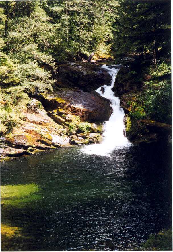
 ***** Siouxon Creek (
Near Chelatchie , WA) : A great summer or winter hike. Go east on
Forest road 54 from Chelatchie and then left on road 57 and 5701. Road is
paved but has some rough spots that require careful
circumnavigation. The trail descends 400 ft quickly , crosses a log bridge and
runs parallel to and 50 ft. above Siouxon creek for 4 miles. Nice
waterfalls and lots of clear inviting pools of water with tints of green and opal.
At the 2 mile point you come to Siouxon fall which is probably the
highlight of this trail. A couple of nice backpacking campsites are
nearby. There is a little side trail 50 yards from the Siouxon fall
viewpoint which goes to the creek above the waterfall where you can wade
and cool off. Its a lot safer than the very steep scramble trail leading to
the inviting pool below the falls. The clarity of the water is pretty
phenomenal allowing you to see right to the bottom of the pools. Submerged
rocks are clearly visible in the deep aquamarine water. In summer the
temptation to take a dip or wade is overpowering. The forest is mixed fir
and cedar with several large cedars and many fallen giants serving as
nursing logs. Forest floor is lush moss and sword ferns. The trail fords a
small creek and then crosses a bridge over Siouxon Creek after 4 miles and
then gradually veers away from the creek towards a smaller waterfall (Chinook Falls). This is a good turn back point. If you continue straight up the trail for 1 mile (instead of crossing the bridge) you will hit a less-visited big waterfall emptying into a limpid pool. This waterfall easily equals the more popular Siouxon Falls and is worth checking out.
(8-10 miles roundtrip, 700 ft.). The much maligned trail park pass sign was posted at trailhead but in a rare reversal was removed in 2004. In 2005 my dog was attacked by a psychotic off-leash akita and the ensuing dog-fight really marred my enjoyment of the hike. pic : Siouxon fall cascades
into a clear pool.(done 8/14/99, as a backpack 7/29-30/2000, to 2nd water fall 6/20/03, 5/16/04, 8/28/05)
***** Siouxon Creek (
Near Chelatchie , WA) : A great summer or winter hike. Go east on
Forest road 54 from Chelatchie and then left on road 57 and 5701. Road is
paved but has some rough spots that require careful
circumnavigation. The trail descends 400 ft quickly , crosses a log bridge and
runs parallel to and 50 ft. above Siouxon creek for 4 miles. Nice
waterfalls and lots of clear inviting pools of water with tints of green and opal.
At the 2 mile point you come to Siouxon fall which is probably the
highlight of this trail. A couple of nice backpacking campsites are
nearby. There is a little side trail 50 yards from the Siouxon fall
viewpoint which goes to the creek above the waterfall where you can wade
and cool off. Its a lot safer than the very steep scramble trail leading to
the inviting pool below the falls. The clarity of the water is pretty
phenomenal allowing you to see right to the bottom of the pools. Submerged
rocks are clearly visible in the deep aquamarine water. In summer the
temptation to take a dip or wade is overpowering. The forest is mixed fir
and cedar with several large cedars and many fallen giants serving as
nursing logs. Forest floor is lush moss and sword ferns. The trail fords a
small creek and then crosses a bridge over Siouxon Creek after 4 miles and
then gradually veers away from the creek towards a smaller waterfall (Chinook Falls). This is a good turn back point. If you continue straight up the trail for 1 mile (instead of crossing the bridge) you will hit a less-visited big waterfall emptying into a limpid pool. This waterfall easily equals the more popular Siouxon Falls and is worth checking out.
(8-10 miles roundtrip, 700 ft.). The much maligned trail park pass sign was posted at trailhead but in a rare reversal was removed in 2004. In 2005 my dog was attacked by a psychotic off-leash akita and the ensuing dog-fight really marred my enjoyment of the hike. pic : Siouxon fall cascades
into a clear pool.(done 8/14/99, as a backpack 7/29-30/2000, to 2nd water fall 6/20/03, 5/16/04, 8/28/05)
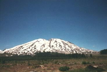
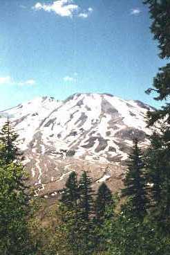
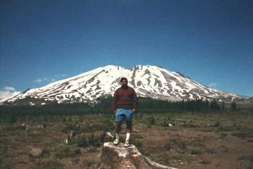
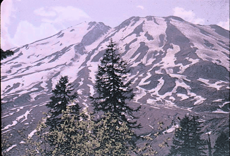
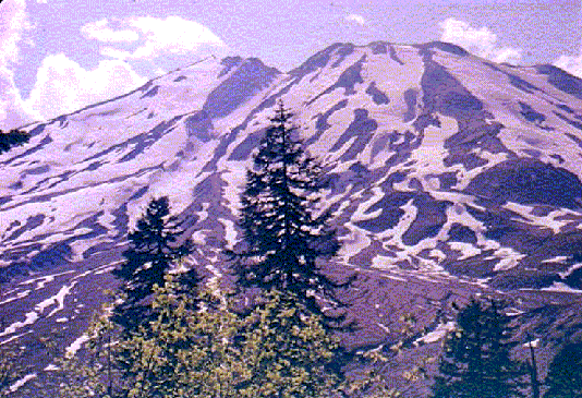
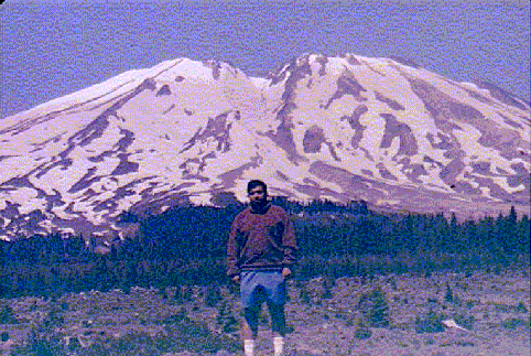
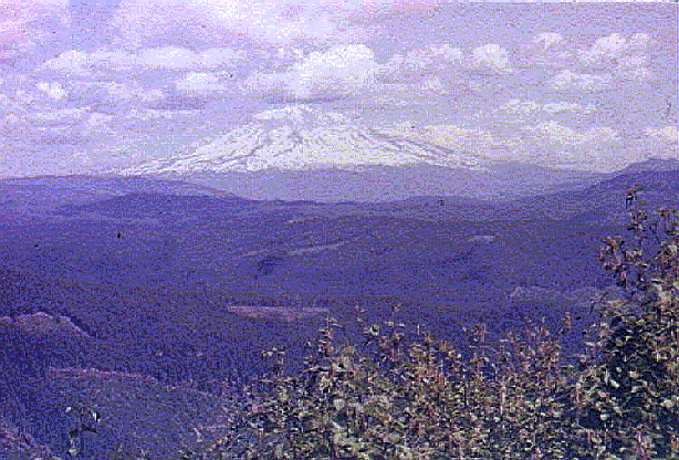
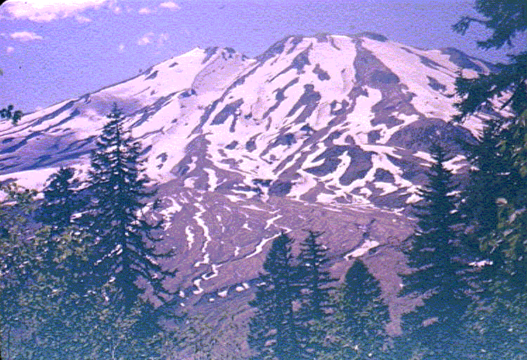
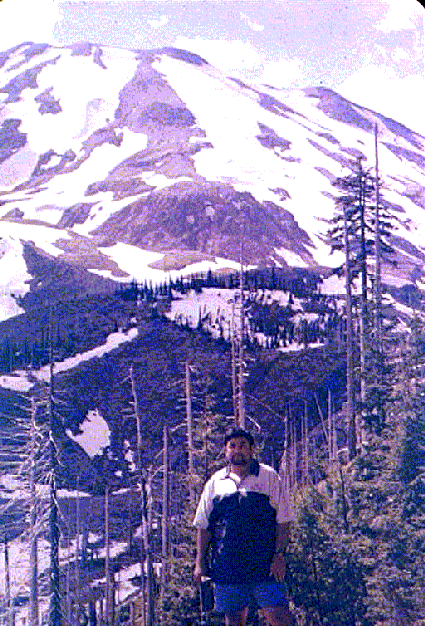
**** Ape Canyon (Mt.
St. Helens) : Nice well-graded trail climbs on a forested ridge
next to the mud flow devastation of the 1980 eruption . The Lahar (Mud
Flow) is a real desolate looking reminder of the power of these volcanoes
to change the landscape. The trail climbs along a ridge with brush on the east (right) side and mature old-growth on the other side. There is one particularly massive Douglas Fir tree perched on the edge of a slope along this ridge. Great views of Mt. Adams and Rainier and stunning close-ups of St. Helens along the way. Eventually the trail comes to Ape Canyon which is a deep notch in the ridge. The trail skirts the canyon and leads to the wide open ash-covered slopes of St. Helens. This area has the somewhat fanciful name "Plains of Abraham". Only downside to this hike is the hordes of
mountain-bikers hurtling down the trail and the hordes of mosquitoes that
descend for a juicy snack at your expense once you stop moving.(11 miles,
1700 ft. elev. gain, done 7/17/99 and 6/8/03) pic, pic, pic, pic, pic, pic,
pic, view of Adams, pic, pic, pic,
pic
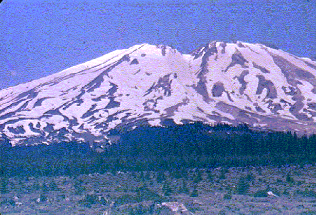
 ***** Ptarmigan trail
and Monitor Ridge (Mt. St. Helens, WA) : This is the highest trail
on St. Helens. Trail starts at 3700 ft. elevation at Climbers' Bivouac
which is a primitive campground for climbers. After 1.5 miles of
meandering through level forest it does a couple of switchbacks over .5
miles and then breaks out of the trees at 4800 ft . A couple of nice views
of Mt. Adams and Hood on the switchback. After 4800 ft. permits are
required to go any higher . Permits cost $15 per person in summer
but are free after Nov. 1st. (I will refrain from fulminating against this
fee but suffice it to say that my views on this permit mirror my views on
the shitty trailhead fees). Anyway, after this the trail ascends Monitor
Ridge by climbing a steep section of boulders with large wooden poles
marking the trail. After the first bouldery section it eases off a little
as you enter a small valley, then there is a final steep section composed of 3 "humps" interspersed with small falt sections. After
that you are on the open slopes of ash. The lower Monitor ridge part of the hike
is quite uninspiring since you cant see St. Helens at all -- its blocked
out by this huge piles of rubble that form the humps. However you can
look south to Mt. Hood, Jefferson and even the Three Sisters on a clear day. Like all
other Cascade volcanoes, the terrain above timberline is sandy, crumbly
ash/scree with loose rocks that make walking treacherous and tiring. A late start and a hurting ankle thwarted me from any such ambitions the first time.
The second time the final hump near 7000 ft again thwarted me since the rocks on the steep slope were covered by a thin and treacherous layer of snow. I will keep trying though.. (7-8 miles round-trip, 2000-2500 ft. ?, done 11/14/99 and 11/3/2001)
***** Ptarmigan trail
and Monitor Ridge (Mt. St. Helens, WA) : This is the highest trail
on St. Helens. Trail starts at 3700 ft. elevation at Climbers' Bivouac
which is a primitive campground for climbers. After 1.5 miles of
meandering through level forest it does a couple of switchbacks over .5
miles and then breaks out of the trees at 4800 ft . A couple of nice views
of Mt. Adams and Hood on the switchback. After 4800 ft. permits are
required to go any higher . Permits cost $15 per person in summer
but are free after Nov. 1st. (I will refrain from fulminating against this
fee but suffice it to say that my views on this permit mirror my views on
the shitty trailhead fees). Anyway, after this the trail ascends Monitor
Ridge by climbing a steep section of boulders with large wooden poles
marking the trail. After the first bouldery section it eases off a little
as you enter a small valley, then there is a final steep section composed of 3 "humps" interspersed with small falt sections. After
that you are on the open slopes of ash. The lower Monitor ridge part of the hike
is quite uninspiring since you cant see St. Helens at all -- its blocked
out by this huge piles of rubble that form the humps. However you can
look south to Mt. Hood, Jefferson and even the Three Sisters on a clear day. Like all
other Cascade volcanoes, the terrain above timberline is sandy, crumbly
ash/scree with loose rocks that make walking treacherous and tiring. A late start and a hurting ankle thwarted me from any such ambitions the first time.
The second time the final hump near 7000 ft again thwarted me since the rocks on the steep slope were covered by a thin and treacherous layer of snow. I will keep trying though.. (7-8 miles round-trip, 2000-2500 ft. ?, done 11/14/99 and 11/3/2001)
In July 2006 I finally made it to the summit. St. Helens was closed in Oct 2004 because of renewed volcanic activity. USFS finally reopened climbing on July 21, 2006 but jacked up the fee to $22 including an outrageous $7 "service charge" on top of the previous fee. I managed to get a couple of permits through a friend who had 2 extra ones. We left town around 4 am and started hiking at 6am. The earlier part of the trail is pretty much as described above. There was still plenty of snow lingering on either side of the ridge, and there were even some snow patches in the forest. The heat wave in Portland with 100 degree temps was also having an effect here and it was very warm in the forest with pesky biting black flies. Things cooled down a little when we reached the ridge since trail was in still in the shade and a nice breeze cooled things farther. We made steady progress with hourly snack breaks. However things heated up considerably once we reached the steep humps. I opted to go on the snow to the east side of the humps but it was too hard for good kick-stepping so I crossed back onto the dirt after the first hump. The sun was beating down pretty fiercely at this point and there was no shade whatsoever. We kept plodding along with increasingly frequent breaks. The going was hot and dusty. We could see people standing on the rim. They orginally looked liked dots but kept getting larger as we got closer. The last couple of hundred feet were the the hardest since the ash provided no support and footing. I finally hauled myself to the crater rim around 12:30. The view from the rim was pretty jaw-dropping. The new lava dome was as raw a piece of geology as I have ever seen. It had bright yellow sulfur vents at its base with steam spewing out from them. The charred top of the dome looked very menacing as it emitted steam that plumed above the crater before dispersing in the breeze. All around the dome were the heavily buckled and crevassed remains of the glacier that had been forming inside the crater since 1980. Every few seconds rockfalls would echo across the crater. The dome seemed to make a lot more noise than could be attributed to rockfall. It almost sounded like rocks were tumbling and rattling inside its massive hulk. The noise emanating from the dome was brittle-sounding and high-pitched - not like the low-pitched rumble of normal rockfall that came from the crater walls. I am guessing thats where lava in pushing up from underneath and building up the dome. The desolation from the 1980 blast stretched into the distance toward Johnston Ridge. In the distance the usual suspects, Rainier, Adams, Hood, Jefferson, Goat Rocks and even the Olympics. I found a perch on the rim and absorbed the view while munching on my sandwich. The rawness of the surroundings was pretty awe-inspiring but also a little unnerving. Even a tiny movement caused rocks to start rolling down the rim into the crater and raising clouds of dust. The walls of the crater were garishly colored with reds, oranges and yellows. We spent almost 2 hours on the rim, wandering a little along it to get to different vantage points. Around 2:15 pm we started the descent. The soft ash provided excellent opportunities for plunge-stepping for the first few hundred feet. After that I tried to find tongues of snow and walk along them. Glissading was an option but I didn't feel like stopping to dig out my rain pants and garbage bag for just a few minutes of glissading on gritty ash-covered snow. As I got closer to the steep humps I moved over to the east side onto the snow, taking care to make sure I was below the crevasses that had opened up in the snowfield. It was fairly steep in places so I dug out my ice axe and shelved one of the trekking poles. Armed with the ice-axe/pole combo I was able to move very quickly along the snow, always staying close to the ridge to avoid the steep drop-off but not not so close as to fall into the gaping moats forming along the edges. It was a lot of fun plunge-stepping in the softened snow and I was down to the lower ridge very quickly. The snow had been frozen solid in the morning but now snow-melt streams were flowing all over the place and I took the opportunity to refill my bottles. The 3 litres of gatorade I started out with were long gone. I ended up drinking almost 5 litres because of the hot day. The rest of the hike was pretty uneventful. We made it down to the TH by 5:15 pm. So 6 hours up, 3 down. Signed out at Jacks on the way home. (Done 7/23/06 4600 ft, 10 miles)
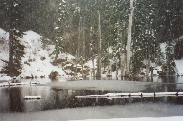
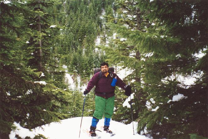
**** June Lake (Mt. St.
Helens, WA): This was a nice snowshoe and I plan to do it as a
hike, come summer. The trail began at the Marble Mountain parking area
which was jam-packed with snowmobilers and their trailers. Fumes were so
thick it was hard to breathe. I had no idea there were this many
snowmobilers in OR/WA. The early part of the trail has a 1/2 mile section
that was infested with snow-mobilers and their noxious fumes. After that,
the angry buzzing of the snow-mobiles diminished and the only sounds were
the crunch and squeak of snowshoes on fresh snow. The June lake trail part
of the snowshoe is 1.25 miles long and ascends along June Creek but you
never get really close to the creek until you come close to the lake. June
lake was reached after a total of 2.5 miles and a crossing of a
snow-covered bridge. It is a very pretty lake with a steep cliff face
behind it and a tall waterfall cascading from the cliff into the lake. The
lake was partially frozen. It started snowing heavily as we reached this
lunch point. I plopped down into the soft snow and absorbed this scene
while consuming some oranges and luxuriating in the pristine whiteness
surrounding us. The whole scene had a magical winter wonderland kind of
look that made the trip well worth running the gauntlet of the
snowmobiles. Afterward we continued upwards on a fairly steep uphill slog
to a viewpoint that is purported to have great views of Hood and Adams.
Unfortunately clouds and fog had not burned off as the weather forecast
predicted, so we didn't get that view.On return we took a shorter and
more direct route back to the trailhead along "Worm Flow" trail.
Supplemental Note: I redid this snowshoe in Mar 2001 and noticed that they
have modified the connector trail( Pine Marten trail) which parallels the
snowmobile trail so you don’t have to deal with snowmobiles most of the
way. The angry buzzing still mars the peace and quiet. On my return I got
turned around somehow and ended up going up the Rock Pit trail and then
coming down the Swift Creek trail. They have a very nice shelter with a
huge stove in the parking lot which makes for a welcome stop on the way
back .
Supplemental Note : In 2002 the snow pack was much better. However
visibility was pathetic and it was snowing heavily. However the hike leader kept going up regardless of poor visibility and I had little choice but to follow. We finally ended up having lunch in near whiteout conditions, trying to huddle among some trees to stay out of the wind. So despite doing this
snowshoe 3 times I have yet to see the views of Helens, Adams etc. that
are touted as the best feature of this snowshoe. Peaceful
scene at June lake On the trail ( 6 miles
round-trip, 800 ft. , done 1/22/00 and 3/4/01 and 1/19/02, 2/7/04, 12/17/05)
***** Lava Canyon (Mt.
St. Helens, WA) If you like cheap thrills, this is the hike. The
parking lot was dauntingly crowded and Forest Service goons were circling
the parking lot checking for trial park passes. The initial part is
extremely crowded and paved with little wooden platforms and interpretive
signs. I noticed several people wearing ghastly pink wristbands and asked
one of them if they were part of a tour group. Turns out the Forest
Service is making them wear these as "proof" of their having
purchased a pass. Jeez, what’s next, tattooed serial numbers on your arm
to prove you are entitled to hike on public land ? Anyway my initial
peevishness quickly wore off as I left the paved trail and descended along
a fairly steep trail to a suspension bridge across the roaring river. The
bridge is fun to cross so I did this a couple of times for kicks, it did
freak out the dog a little bit though. After getting cheap thrill #1 , I
proceeded down the trail along the true left side of river. The crowds really
thinned out on this portion. Apparently most of the people seem to stick
to the paved trail and suspension bridge area. The trail comes out beside
the river briefly above a thundering two-tiered waterfall. It then
continues to descend at a rapid rate above the river. The river is going
down even more rapidly via a series of scenic waterfalls and slot canyons
so it always stays considerably below trail. The trail stays in trees most
of the way but has a few exposed stretches with nice views that may be scary
for people who don't like heights. A tourist did die on this trail in
2000. The other side of the river is heavily forested with stately fir
trees at higher elevation and mixed maple and fir/cedar lower down. There
are also skinny plants with little yellow flowers and spiky leaves and
little thorns. Many of these plants have little spitball like stuff,
probably some insects doing. The exposed stretches are somewhat dangerous
and can be really tricky where its muddy or slick. At one point there is
some rope secured to cliff to facilitate a stream crossing. Numerous side
streams are coming out of the side of the cliff and crossing trail.
Finally the trail emerged from the growth to a nice spot above the river
with a 3 strand waterfall. At this point the trail went away from river,
crossed a small side stream and abruptly came to a vertical steel ladder.
The rungs felt somewhat slippery and there is no way I was going to haul a
100 lb dog down that thing. So I decided to explore the last view point
close to this point and got a scary lesson about how dangerous this trail
can be. My dog ventured out here with me and was ambling around the way
dogs do. He slipped on some slimy rocks with a stream trickling across. I
watched in sickened horror as he got up and then slipped again down to
within a couple of feet of the steep 200 ft drop-off to the river below.
Luckily he managed to find surer footing and rapidly scrabbled away from
the edge. Whew. The return was heavy going with the steep uphill. However
at least the danger of slipping is less since you are not going as fast as
downhill. The return to suspension bridge took me an hour. Ran into a
badly sun burnt biker who had hauled his bicycle up that ladder. On the
way back I crossed over the bridge one more time with the now chastised
pooch in tow. The trail goes up along the river for a brief distance then
crosses back to the paved trail side. A very pretty hike and not as
crowded as the trail head seemed to suggest. (5-6 mi., ~800 ft, Done
7/23/01).
Redid this hike in June 05 without a dog. This time we did go down the step ladder which is a bit daunting. The trail soon came to a nice saddle with view of a black volcanic cliff with hexagonal basalt pillars known as "The Ship". There was a side-trail to the top of this cliff which involved climbing another small stepladder. The trail crosses a bridge about a mile from the stepladders and enters a relatively uninteresting section where the rushing stream enters more open terrain. There is a herd of elk that can be spotted here since it is prime terrain for them with lots of brush. We opted to turn back here instead of grinding out the last mile to the end at a parking lot. (Done 6/12/05)
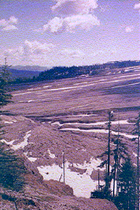
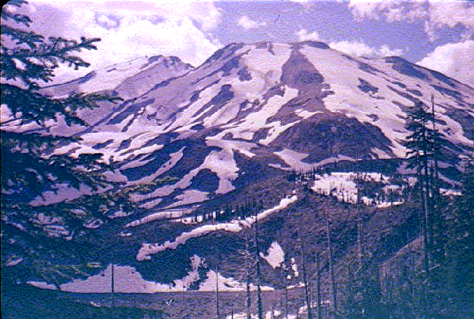
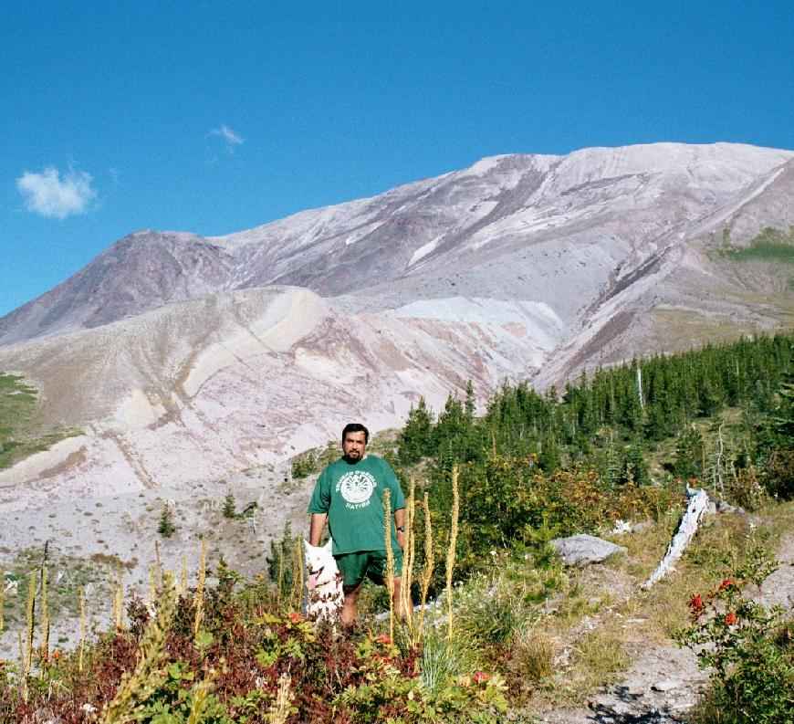
**** Sheep Canyon (Mt.
St. Helens NM, 17 miles north of Cougar, WA) A great hike on the
western flank of the mountain with good views of the havoc wreaked by 1980
eruption. The trail starts at the end of Forest Road 8123. There are many
huckleberry bushes in this area and were loaded with berries when we did
the hike. After about half a mile the trail came to a pretty 2 tier
waterfall and crossed a bridge over Sheep Canyon. It then descended
through mature fir and hemlock forest to the Toutle River. The trail crossed a
nice stream with backpacking possibilities just before reaching Toutle
River. Here it intersected the Loowit Trail. I headed left right down
Loowit a while to the bank of the river, as the O'Sullivan book
recommends, and got a good view of the blast zone. Fallen tree trunks were
scattered like match sticks on the hills across the Toutle River. Some
were still rooted in the ground ,strikingly bent at 30 degree angle to the
ground away from direction of the blast. The Loowit trail was visible
snaking its way across the ashen slopes towards the maw of the volcano. It
looked tempting but I decided to stick to the agenda. The right fork of Loowit
trail ascended at a fairly rapid pace up and away from the river. Initial
portion was hot and brushy but things cooled off somewhat as the trail
gained altitude and entered mature forest of big trees. Finally after what
seemed like a long climb, the trail broke out on top of the ridge amongst
a scattered forest of spruce and what appeared to be bristle-cone pine.
Some meadows with a few wildflowers but nothing majorly flowery. The
barren and snow-less bulk of St. Helens loomed over the trail in this section with silver sun-bleached snags providing s scenic foreground.
After meandering through this timberline stuff for a while the trail crossed the wide and rocky Sheep Canyon . Sheep Canyon Trail lead quickly in a mile and a half
to the bridge mentioned above to complete the loop. A good hike with a
little bit of everything. (7 mi., 1700 ft, Done 8/25/01).
In 2006 I redid the hike but FR8123 is now blocked by a washout at the Blue Lake TH. USFS could easily fix this but their traditional laziness and hostility to hikers is evident in the huge berm on the road. We were forced to hike an extra 3 miles (one-way) just to get to the old TH. At least its through nice mature forest with occasional glimpses of the lake and stream below. The Loowit trail has been closed in this area due to "volcanic hazards" since 2004. We proceeded up the Sheep Canyon trail to the Crescent Ridge area and were rewarded with one of most profuse beargrass displays I have ever seen. The combination of silver snags, bear grass and St. Helens belching small steam plumes meant we spent a lot of time taking photos and reveling in the scenery. The only downside were pesky biting flies that were out in force. I also saw some mountain goat hair on this part of the trail. We didn't do the loop but still ended up hiking a good 11-12 miles. (11 mi, 1000 ft, Done 7/09/2006)
Topping out after the climb up from Toutle River
***** Spirit Lake : Mark, Denise and I did this hike. We started out from Johnston Ridge and soon left the throngs behind. The trail lost elevation slightly as it ran along the ridge. Great views of desolate wasteland and the gaping maw of the volcano. Trail had a very cool exposed traverse and then descended into the ashy desolation after coming to junction with Truman overlook. We continued along the trail with frequent cairns and wooden poles marking the way. There were strict warnings posted about not wandering off-trail. The trail came pretty close to the lake at a few points. The lakeshore was littered with huge tree trunks from the 1980 eruption. Some ashy areas were quite boggy and resembled quick-sand. The trail now started following a stream that was emanating from the crater and emptying into Spirit Lake. The water of the stream was warm and smelled a little sulfurous. We turned back before getting to Loowit Falls because it was getting late. The views on the way back were even nicer because the setting sun really accentuated the landscape features. (8 miles, 1000 ft, Done 8/31/2003).
* Kalama Ski Trail SS: We were planning to go up to Marble Mountain but the road was blocked after Cougar Sno-park due to snow slide. To make the best of a bad situation we decided to snowshoe up the only trail available namel Kalama Sji TRail 231. There isn't much to say in favor of this trail except you get a workout. There are a couple of mediocre views along the way bit the resit is in the trees. The trail never strayed too far from the snowmobiles roaring up the nearby road. We struggled along for 2 to 3 miles but then finally gave up and returned via the road. (4 miles, 500 ft, Done 1/11/2004).
**** Lewis River (Near Mt. St. Helens, WA) : This was a group hike arranged by Sierra Club. Long drive to trailhead. The trail started at Lower Falls which is a pretty impressive affair with a tiered waterfall on the right side and a simple waterfall on the right. The trail was pretty level with a few small ups and downs. The river remained within view for most of the length of the trail. In about 1.25 miles we came to Middle Falls which was also impressive but not as good as Upper and Lower falls. The trail was washed out at Middle Falls and we had to go up a side trail and then scramble a little bit to get back on the trail. After that the trail ran into a large number of freshly toppled trees that made it feel like an obstacle course. This section also had some mature old growth trees. After clearing these hurdles we reached the Upper Falls which was a spectacular affair with a big pool at its bottom. We stopped for a leisurely lunch here before progressing to the top of Upper Falls which is very pretty in its own right. Finally we came to a relatively smaller waterfall called Taitnapum Falls. Here the trail came to the road and we turned back and returned the way we came. Saw some mushroom gatherers and maountain bikers along the way. Fall colors were beginning to show here and there. Guess another summer of high-country hiking is over. This is one of the better waterfall hikes I have done in the NW. On the way back there were a short side trails to another couple of falls. We stopped and checked out Big Falls which was a fairly nice sized waterfall. (7 miles, 700 ft, Done 10/6/2002, 5/2/2004).
Junaid Omar
Last modified: Mon Jul 24 14:55:31 PDT 2006