|
Léarscáileanna Maps |
|
|
Léarscáileanna Maps |
|
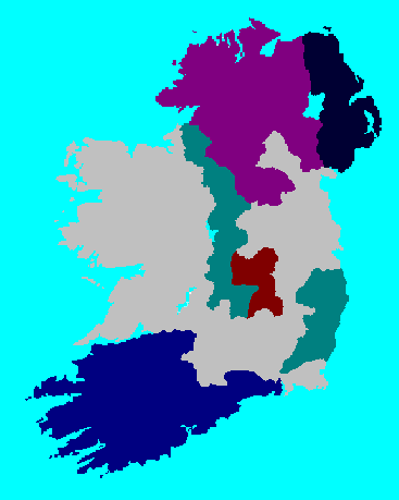
The English Plantations in Ireland (1550-1620)
|
Wine = The Laois/Offaly Plantation
of Mary in 1556. Navy = The Munster Plantation of Elizabeth in 1586. Purple = The Ulster Plantation of James I in 1609. Teal = A Later Plantation of James I. Deep Blue = Privately Planted by Montgomery and Hamilton. |
Cromwell in Ireland
(1649)
The Cromwellian Settlement
"The Settlement which unsettled everything"
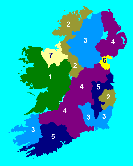
1= Lands reserved for the Irish. "To Hell or to Connacht"- Cromwell. 2= Four Counties given up in 1654 as payment to the Munster garrison. 3= Seven counties, additional security to soldiers. 4= Ten counties divided between the Adventurers* and the soldiers. 5= Four counties reserved by the English government. 6= County Louth, additional security to the Adventurers*. 7= Parts of Connacht subsequently taken from what was reserved for the Irish as additional security to the soldiers who had fought in England during the English Civil War. |
| *Adventurer= A person who subscribed, "adventured" a sum of money for the equipment of an army to surpress the Rising of 1641 on the security of lands to be confiscated from Irish proprietors. |
"To Hell or to Connacht"
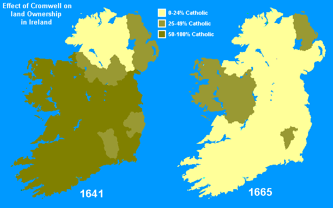
| "The Cromwellian Settlement did not succeed in it's aim of making the people English. A survey ordered by the English Parliament in 1659 found that the proportion of Irish people to English in the 4 Provinces was: Munster 10 to 1, Leinster 13 to 2, Ulster 5 to 2, Connacht 12 to 1...............The great change was in ownership of Land. In 1641, Catholics had three fifths of the Land in Ireland, by 1665 they held only one fifth, most of this in Connacht."- The Age of Renaissance and Reformation. |
| Map taken from "Ireland the Island / Éire an Oileán" site. |
Return to index